Search
Emergency and Disaster Management
Monitor events, improve response, drive resilience
Transform Disaster Response, Recovery, and Resilience
Accelerate disaster response with daily, high resolution imagery. Mitigate risk, get situational awareness, and improve recovery with before, during, and after disaster imagery, anywhere on Earth.
Get situational awareness, on-demand
Our program offers government, commercial, and non-profit organizations flexible monitoring options to deliver the necessary data when disaster strikes.
- Choose from always-on monitoring by region, or event-activated monitoring anywhere in the world
- Access analysis-ready, pre-processed data within 24 hours of capture
- Easily ingest Planet imagery into your tools and workflows with our simple API
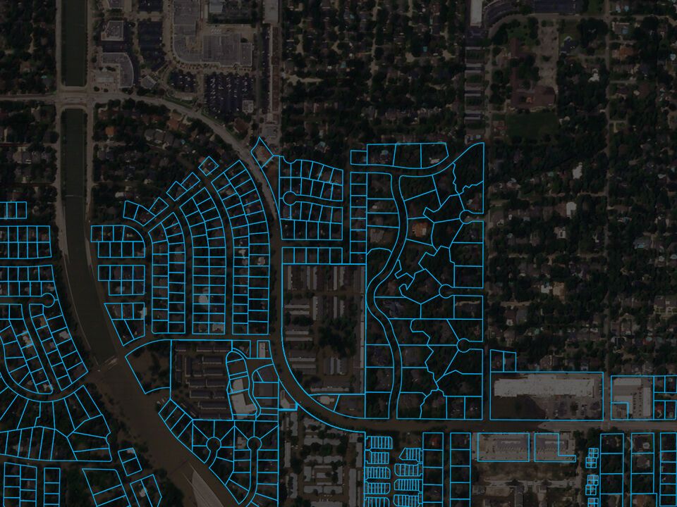
g 635 Attingham Drive
FLOODED
606 Val Lena Circle
NOT FLOODED
123625 Huntingwick Dr
FLOODED
123627 Huntingwick Dr
FLOODED
123629 Huntingwick Dr
FLOODED
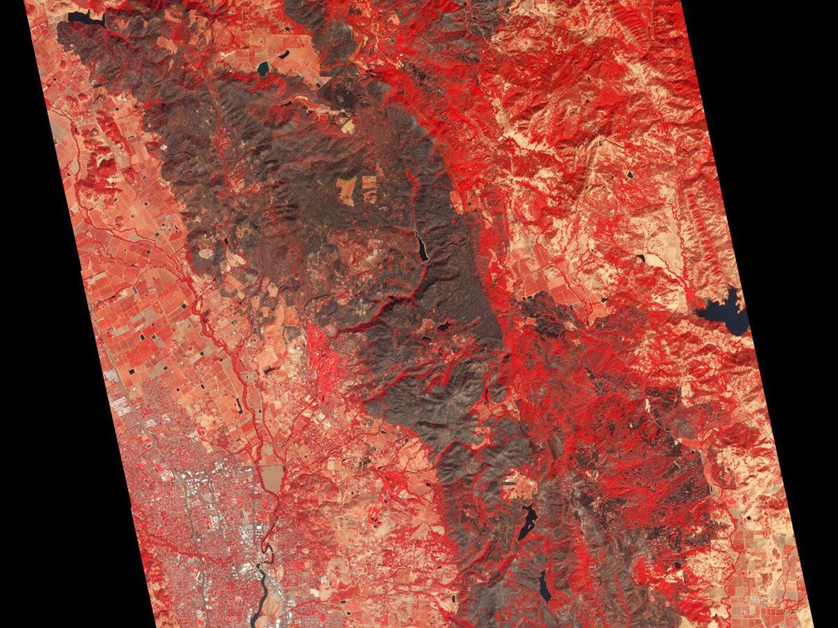
October 8, 2017
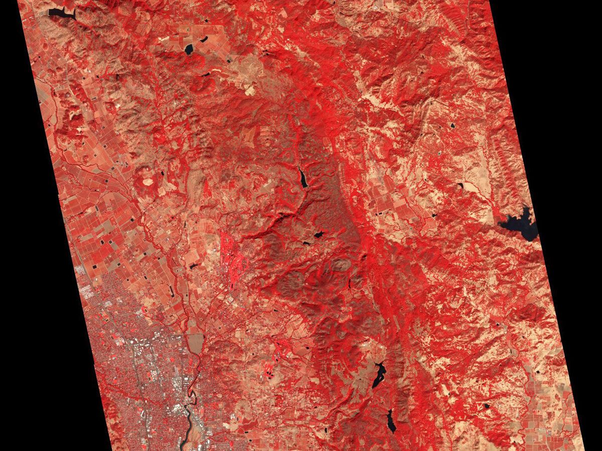
October 15, 2017
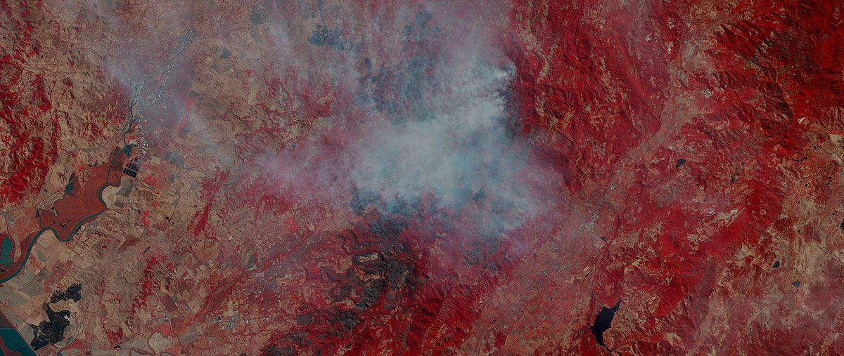
Near infrared imagery reveals the extent of wildfire damage in Napa Valley, CA
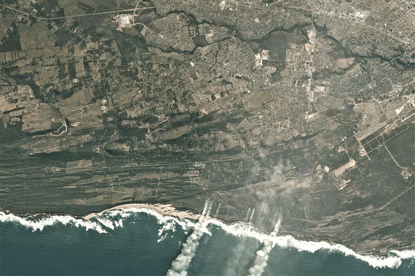
Monitor disasters at global scale
Planet’s daily, global monitoring serves as a critical information source, enabling emergency management professionals to act precisely and quickly.
- Identify damage extents and evaluate access to critical infrastructure
- Direct response efforts with sub-meter resolution detail
- Plan and monitor recovery operations as events unfold
Drive recovery and build resilience
Planet’s imagery archive and daily collections enable informed action across the disaster risk-response-recovery-resilience continuum.
- Understand and mitigate disaster risk exposures, before they occur
- Improve modeling, and understand adaptation with archive imagery since 2009
- Drive long-term recovery with continuous monitoring
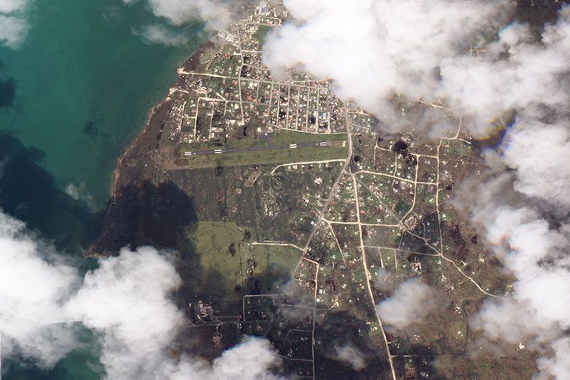
September 2017: Damage on the Western half of Barbuda Island from Hurricane Irma
June 2017: Wildfire devastation in Western and Southern Cape provinces of South Africa
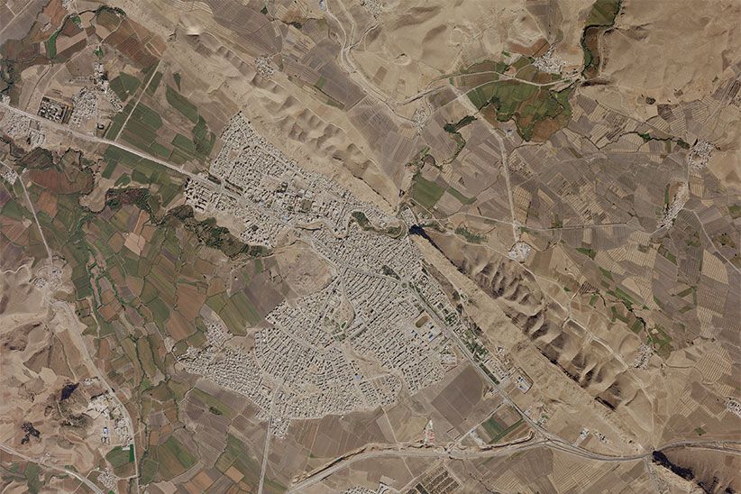
November, 2017: Destruction in Northwest Iran after a 7.3 magnitude earthquake near the Iran-Iraq border
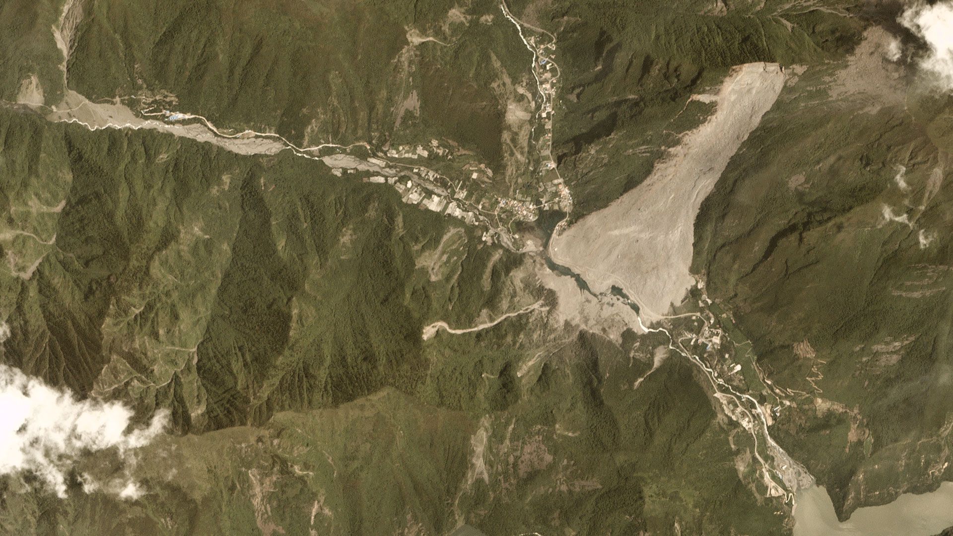
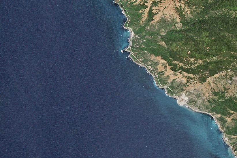
May 2017: Over a quarter mile of land outside of Big Sur, CA slides into the Pacific
June 2017: Tornado pathway visible after touching down near Pine Bluffs, WY
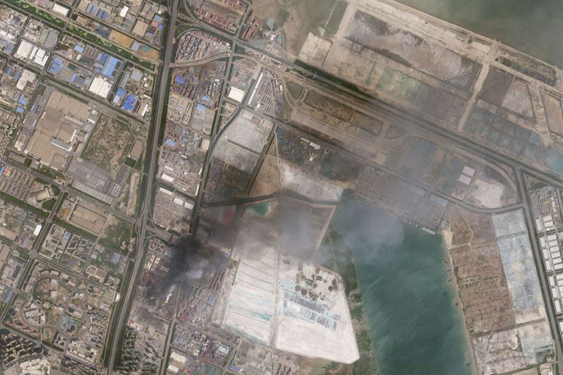
August 2015: Blast damage after a large chemical explosion at the Port of Tianjin
Disaster Data Program
As part of our support for the International Charter for Space and Major Disasters, Planet occasionally makes limited imagery available directly to humanitarian organizations and other coordinating bodies for free.
READY TO GET STARTED?
© 2026 Planet Labs PBC. All rights reserved.
| Privacy Policy | California Privacy Notice |California Do Not Sell
Your Privacy Choices | Cookie Notice | Terms of Use | Sitemap
