Search
Energy and Infrastructure Satellite Monitoring from Planet
Gain greater insights into energy and infrastructure, oversee your assets, monitor competition, and mitigate disasters before they become costly.
Energy and Infrastructure With Planet
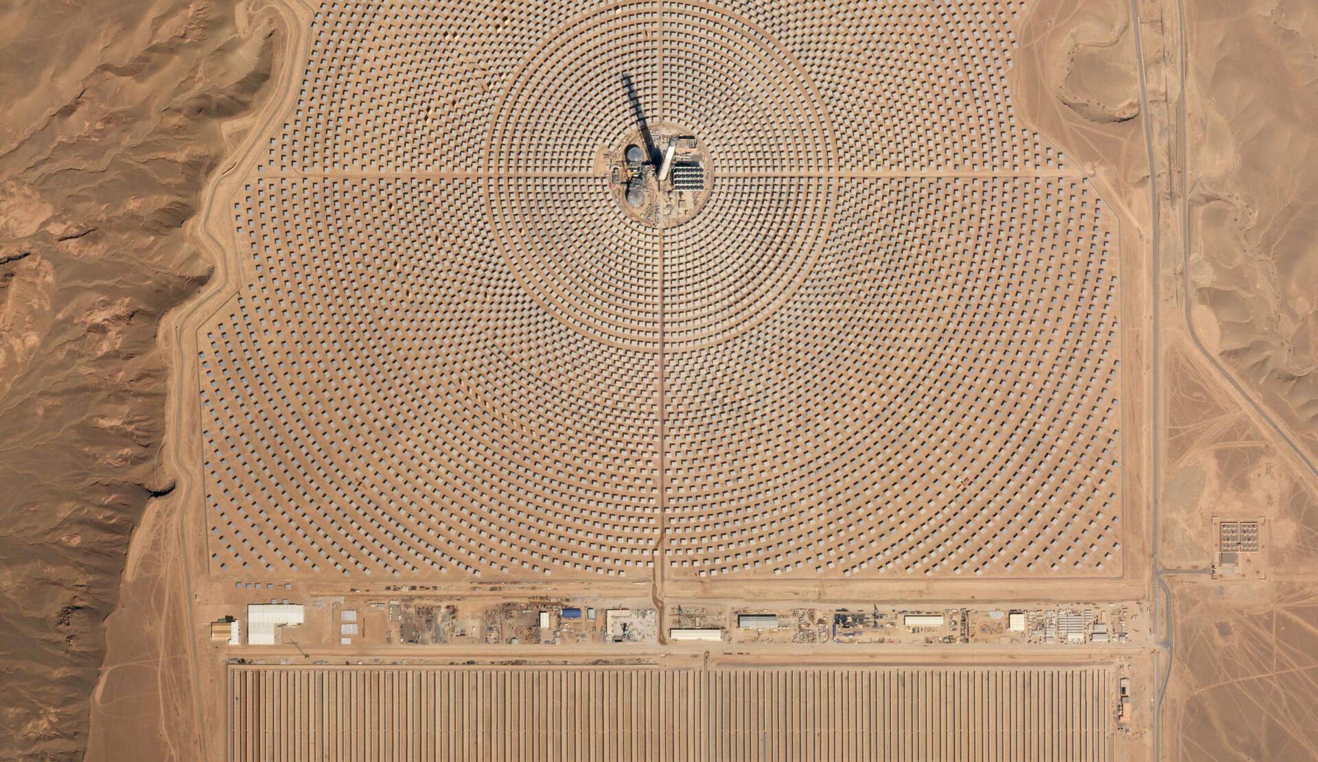
Monitor Energy and Infrastructure from Space with Planet’s High Cadence Satellite Imagery
Enhance operational efficiency by reducing the need for human inspections, develop a complete overview of your assets across geographically dispersed regions, manage risks to your business, and evaluate the activity of competitors in near-real-time, with Planet’s comprehensive, high-resolution, global intelligence.
Continuous, High-Quality Imagery
Daily delivery of high-resolution imagery and insights from Planet
Global Coverage
Continuously updated, spatially accurate, and analysis-ready data from around the world
Preprocessing Capacity
Automated preprocessing with raster functions before you received any data
Historic Image Library
Monitor developments to energy assets and infrastructure over time
Oversee energy developments and keep operations on schedule with Planet’s high-frequency satellite imagery. Transform ground-level detail into actionable insights by combining Planet’s daily imaging and access the information you need directly from Planet’s automated, cloud-based system.
Monitor Assets and Infrastructure
Map and Monitor Geographically Dispersed Assets with Planet’s Frequent and Scalable Satellite Imagery
With Planet, monitor changing and fixed assets on a local, national, and international scale. Planet satellite solutions let you monitor encroachment, predict market fluctuations, and maximize operational efficiency and security.
Get Planning Oversight
Plan the construction of infrastructure, oversee project development, and anticipate delays
Identify Issues Promptly
Detect encroachment, monitor right of way, and relocate sites overgrown with vegetation
Measure Environmental Aims
Map environmental impact, reclamation, and closure projects
Monitor Asset Condition Remotely
Remote satellite visualization of damages, degradation, and corrosion
Make Informed Decisions
Analyze proposed sites for future infrastructure projects
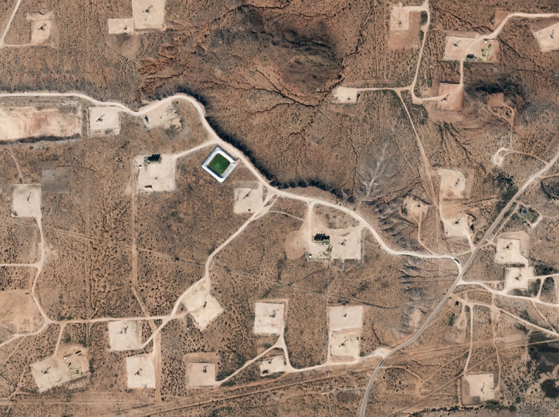
Planet satellites identify well pad construction and onsite equipment around Big Spring, Texas from 2009 through 2017.
Market Analysis
With Real-Time Data on Ground Conditions and Competitor Operations, Planet Gives You the Edge on Industry Intelligence
Monitor areas of interest around the world to derive timely intelligence about regional competitors and the global market. Take rapid, informed action with up-to-date information and satellite imagery of your assets globally.
Corroborate Facts
Supplement or validate third-party intelligence with near-daily Planet imagery and platform
Evaluate Competitor Activity
Observe competitor activity, production methods, services, and equipment
Identify Market Changes
Detect key infrastructure changes and construction developments
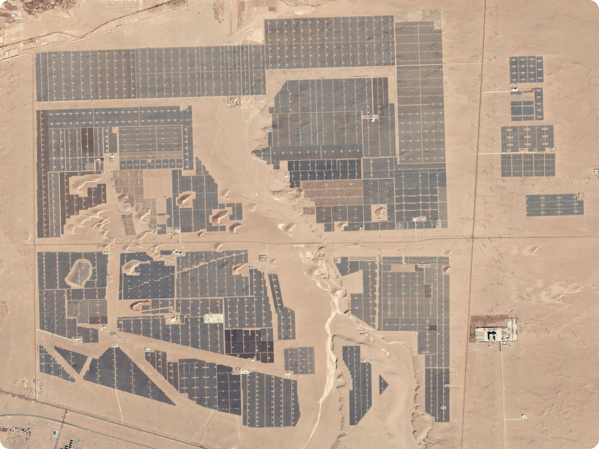
Dragline activity at Coyote Creek Mine picks up in November, slowing at Beulah Mine over the same period. Beulah Mine lost its local contract to Coyote Creek Mine in June.
Manage Risks
Assess and Mitigate Operational Risks and Natural Hazards with Planet’s Cloud-Based Infrastructure and Automated Data Pipeline
With Planet, identify natural hazards and respond to unanticipated disasters promptly to ensure public safety and environmental health.
Reduce Costs
Manage risks while reducing the need for labor-intensive inspections
Identify and Track Hazards
Understand disaster quickly with before and after imagery and deploy the right resources
Mitigate Risks
Prevent disaster with up-to-date asset and right of way monitoring
Streamline Decision-Making
Anticipate market effects and investment impact with ground-truth imagery
Planet satellites capture evidence of the Colonial Pipeline leak just outside of Alabaster, Alabama 24 hours before news broke on September 9, 2016.
Anticipate Impact
Anticipate Global Impact on Your Business with Planet’s Comprehensive Global Vision
Planet’s global coverage helps you monitor assets abroad and perform due diligence on risks before they affect your operations and investments.
Greater Coverage
Ground truth imagery of geopolitical hotspots from anywhere in the world
Remote Access
Observe strategic assets in remote and inaccessible areas
Increase Visibility
Monitor production indicators and global energy supply in non-transparent markets
Despite low oil prices, Saudi Aramco announced that they would move ahead with new expansion at their Khurais production facility in 2016.
Explore planet products
Map and Monitor Infrastructure and Energy Projects with Planet’s Range of Satellite Image Solutions
Planet provides geospatial solutions that are frequent, granular, and scalable. Available through a simple cloud-based system, Planet solutions provide the information you need to make timely, informed decisions.
Planet Monitoring
Continuous view of any location on Earth’s coastlines
Planet Tasking
Rapid revisit, global intelligence
Planet Mosaics
Current, complete
analysis ready
Planet Analytic Feeds
Transforming imagery to insights
Planet’s Professional Services team provides a range of services to help you efficiently implement satellite technologies within a business context. Planet provides launch programs for onboarding and a range of workshops to build and advance knowledge about the Planet Platform. Planet’s Professional Services also include expert guidance on the integration of Planet into your workflow, alongside a range of data services to help you manage and monitor infrastructure and energy projects.
Learn More About Planet Satellite Constellations for Energy and Infrastructure
Planet’s high cadence monitoring and 3.7 meter resolution imagery allows you to monitor dispersed assets and infrastructure projects with ease. Get in touch to learn more about how Planet solutions can ensure your business remains at the forefront of technology.
© 2026 Planet Labs PBC. All rights reserved.
| Privacy Policy | California Privacy Notice |California Do Not Sell
Your Privacy Choices | Cookie Notice | Terms of Use | Sitemap
