Search
Mapping and GIS Imagery with Planet
Update GIS data, visualize topographies, and enhance UX design with Planet data.


Planet for mapping
Planet Provides GIS Data and Imagery for Accurate Mapping that Mirrors Geography
With Planet, display and interpret current geographical information with frequent high-resolution imagery. Update your GIS layers and mapping applications to display real-time data and improve accuracy in geoinformatics, UX, logistics, and planning.
Global Coverage
350+ million square kilometers of imagery captured daily
Comprehensive Library
10+ billion square kilometers of imagery dating back to 1972
On-Demand Imagery
Access data and images through a simple cloud-based system
Data Integration
Streamline data integration with Planet’s API and GIS applications
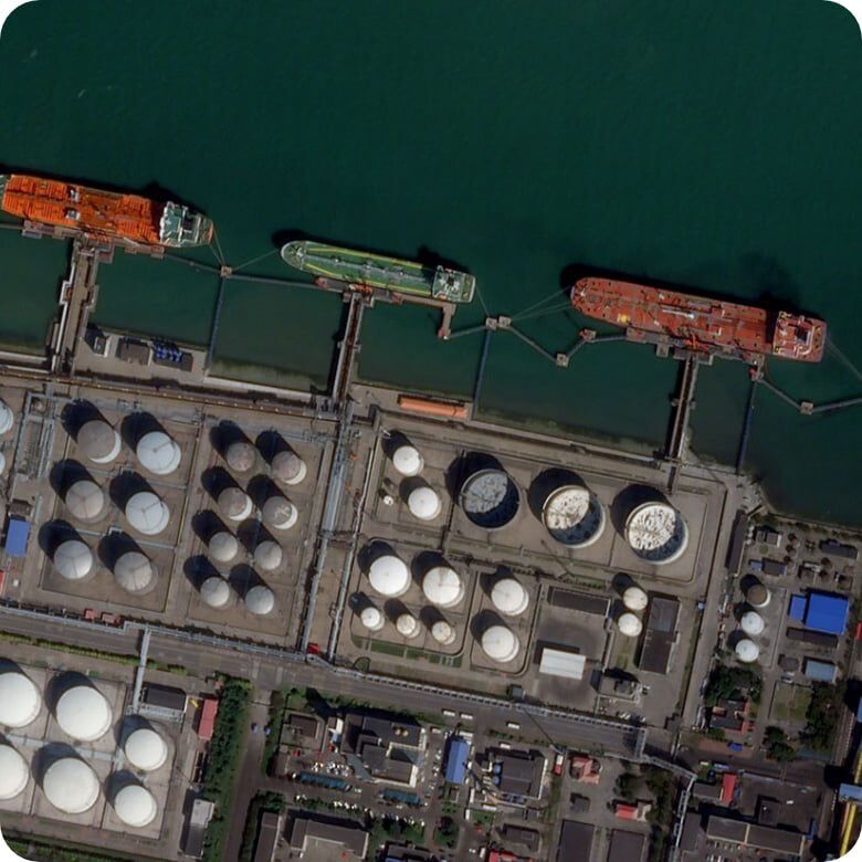
Spatially accurate data and high-resolution satellite imagery are essential for location-based services and applications. With frequent imaging and object detection through machine learning, Planet can help you create maps that are truthful to ground conditions.
Location-based services
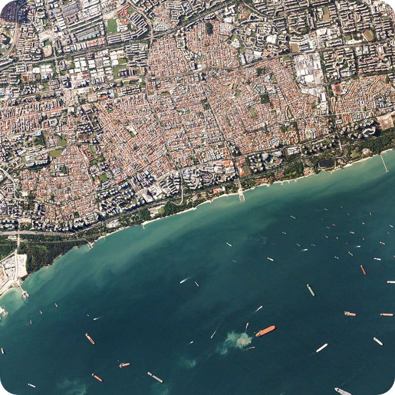
The Most Current and Complete Imaging for Location-Based Services and Analysis
Planet captures 350+ million square kilometers of imagery daily, providing a current and complete view of the world directly to you. Determine your AOI, and use Planet data for location-based services and analysis in mapping.
Verify Spatial Data
Refresh out-of-date spatial data with monthly Mosaics or daily global imagery
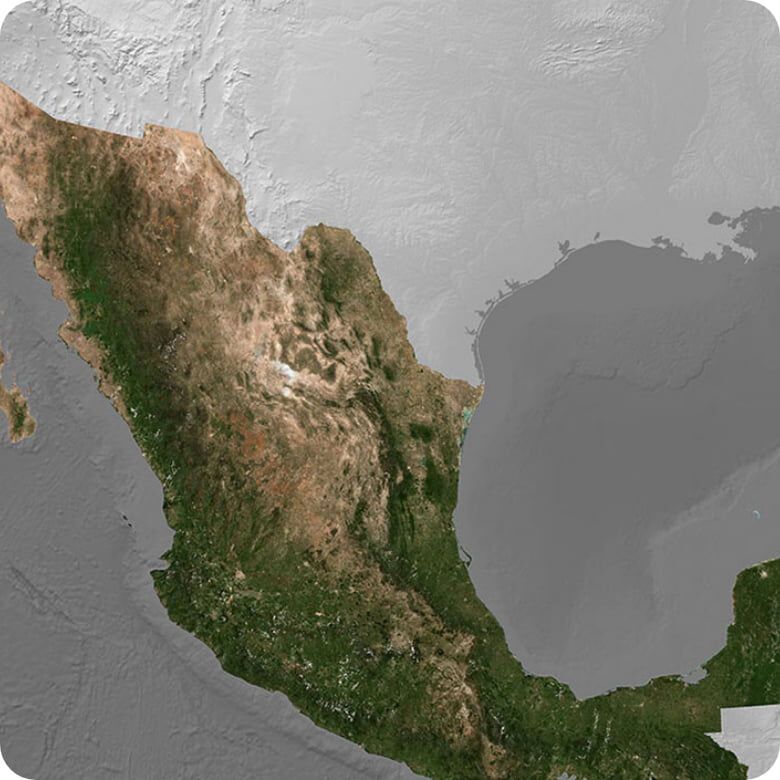
Provide Greater Coverage
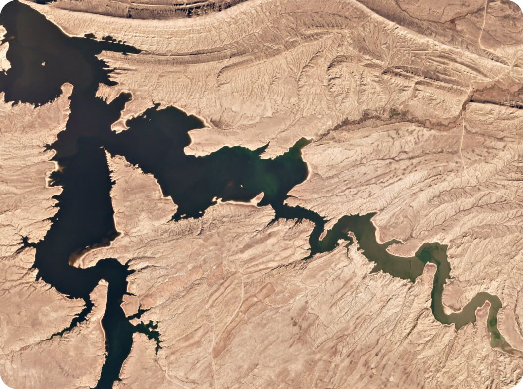
Access and analyze hard to image regions with Planet Monitoring at 3–5m resolution
Maintain Data Consistency
Ensure data consistency within GIS and across user interactions
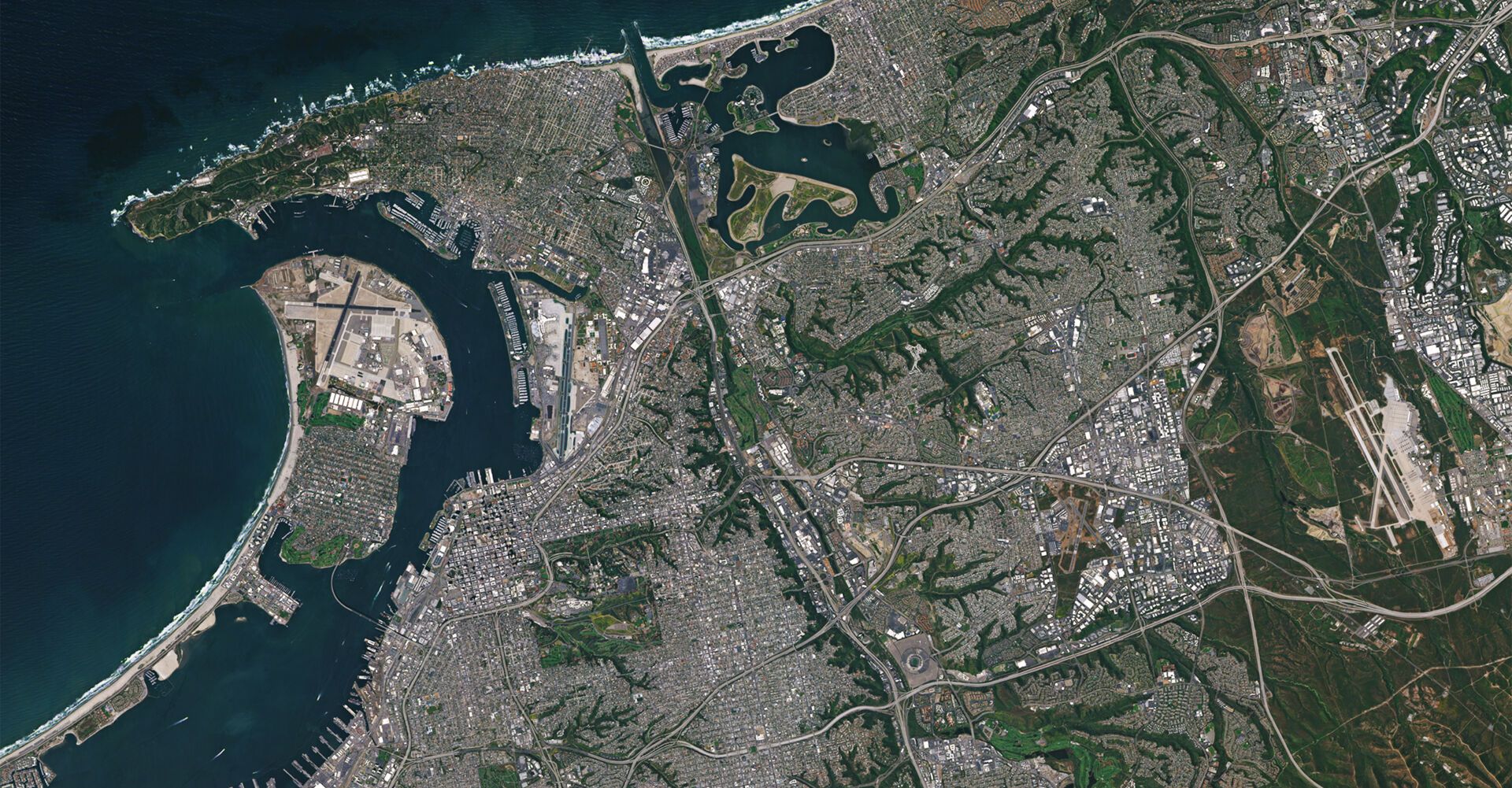
![[object Object]](https://cdn.sanity.io/images/hvd5n54p/production/74003aa7f0a2a1c92322d7d71f21d7a1a155cb89-1920x1114.jpg?auto=format)
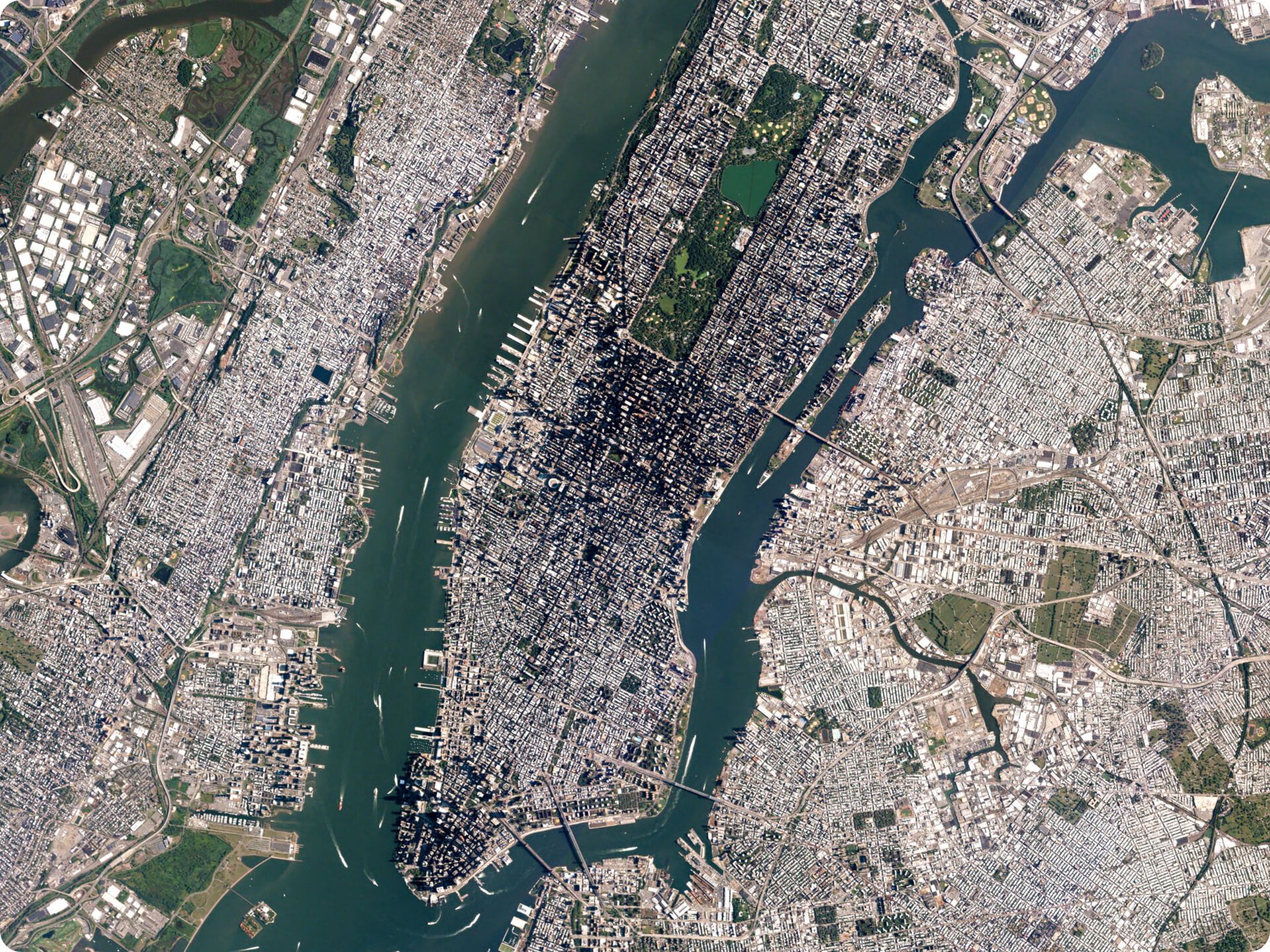
Open Street Map identifies known roads in Dubai, United Arab Emirates, similar to Google Maps’ output of the region
Open Street Map identifies known roads in Dubai, United Arab Emirates, similar to Google Maps’ output of the region
![[object Object]](https://cdn.sanity.io/images/hvd5n54p/production/25736139df78ee401a2477c1323d2074554ed6d1-1920x1114.jpg?auto=format)
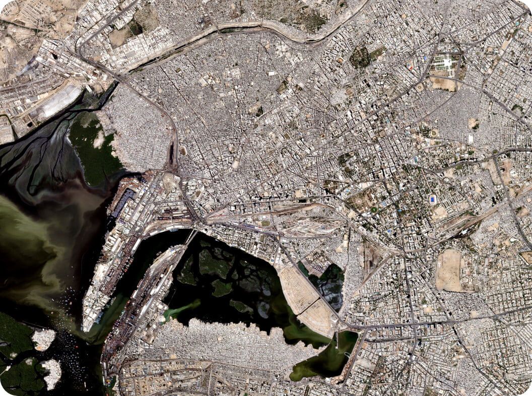
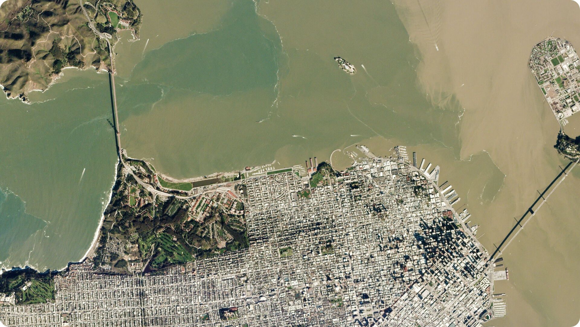
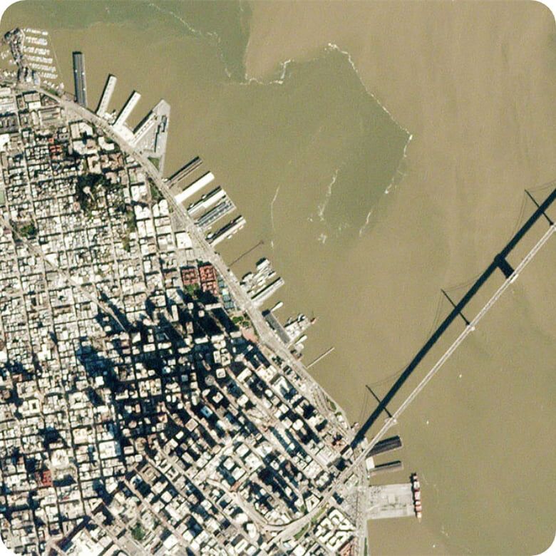
Recent PlanetScope imagery shows rapid urban growth and infrastructure development
Recent PlanetScope imagery shows rapid urban growth and infrastructure development
![[object Object]](https://cdn.sanity.io/images/hvd5n54p/production/9b77e6946927abefc1c049717b3fd9bc1d89f91c-1920x1114.jpg?auto=format)
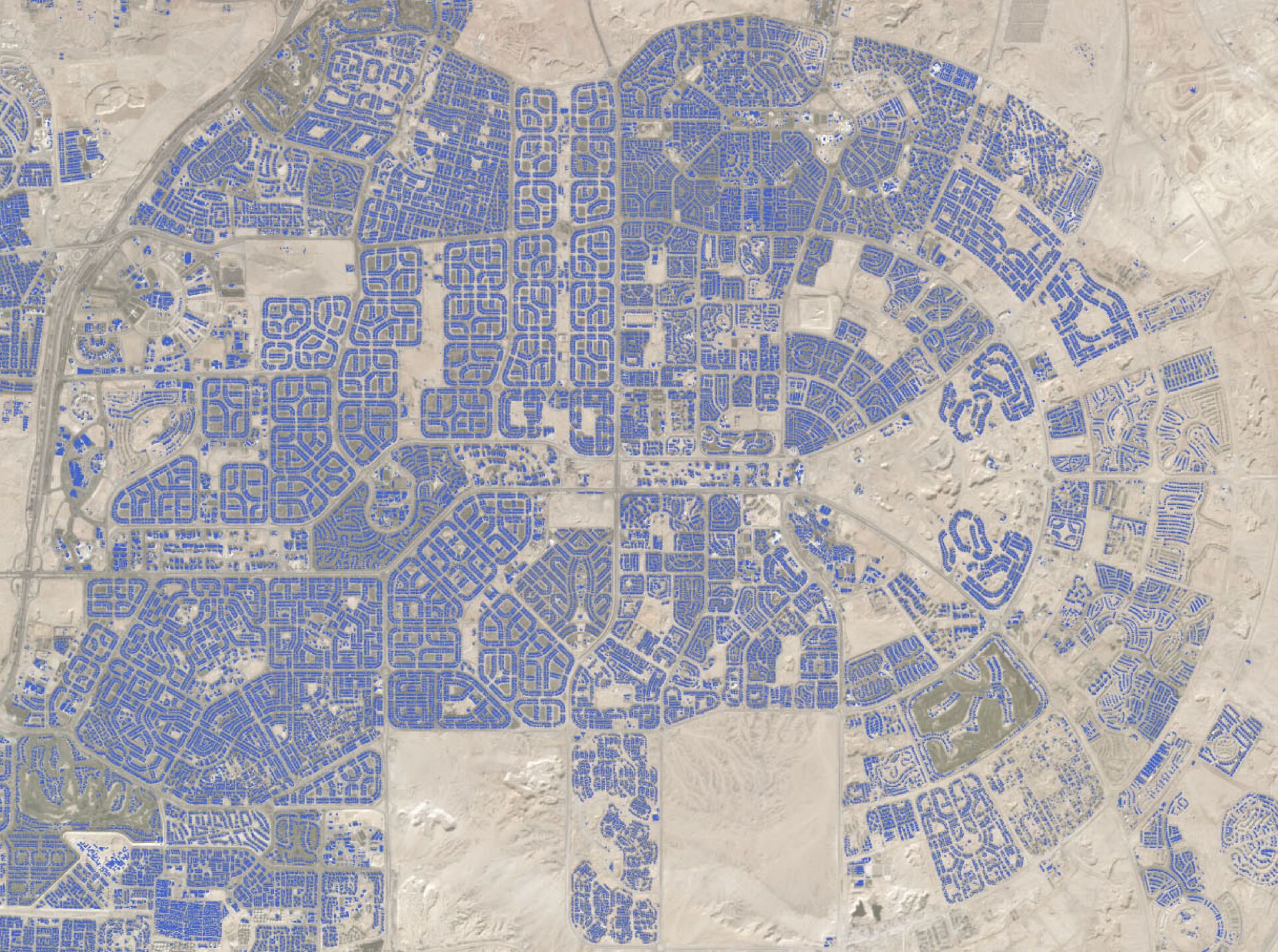
CrowdAI road detection algorithms find and map new roads where traditional mapping lacks context
CrowdAI road detection algorithms find and map new roads where traditional mapping lacks context
Topography with a time axis
Enhance Digital Experience and Data Analysis with Accurate Location Information
Leverage Planet’s comprehensive, timely global data to enable precise geographic analytics, intuitive interfaces, and maps with informed oversight.
Visualize Change
Map, display, and analyze data against recent and historic topographic information
Leverage Planet’s Image Archive
10+ billion square kilometers of Planet imagery from 2009 until today, and public domain from 1972
Derive Timely Insights
View changes and developments in land use and infrastructure as they happen
Urban growth and development in Williston, North Dakota from 2009 to 2017
Platform integration
Integrate GIS Data and Analysis Directly into Your Workflow
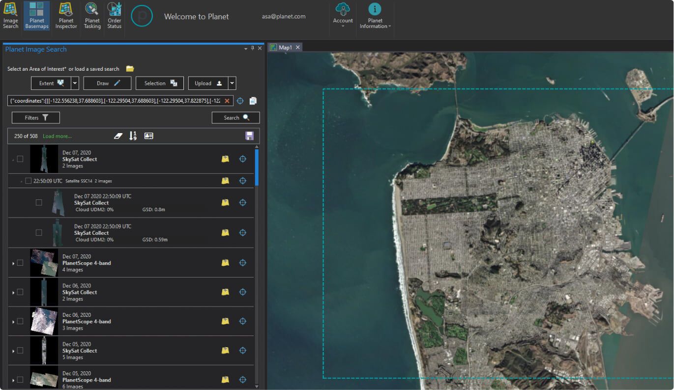
Access data feeds directly, search and filter imagery, and update systems to reflect ground truth with Planet’s API, automated cloud-based system, and leading GIS tools.
Simplify Data Updates
Frequently and easily update your applications with cloud-based imagery
Integrate Downloads
Leverage Planet’s platform and API for direct download or to create custom data streams
Improve Workflow
Seamlessly integrate spatially accurate, analysis-ready scenes into your systems

Data options
Discover a Data Plan that Works for You
Planet provides custom monitoring, tasking, and mosaics for mapping and GIS applications. Build imagery-first environments that inspire users and customers with the data plan that suits your solution.
Medium Res Monitoring
High Res Monitoring
Imagery and Archive
Mosaics
Explore planet products
GIS Data Options and Satellite Imagery Solutions from Planet
Planet provides custom Monitoring, Tasking, and Mosaics for mapping and GIS applications. Build imagery-first environments to inspire users and customers with a data plan that suits you.
Planet Monitoring
High frequency, global coverage
Planet Tasking
On-demand, high-
resolution images
Planet Mosaics
Current, complete
analysis ready
Planet Analytic Feeds
Transforming imagery to insights
Planet’s Professional Services Planet’s Professional Services team provides a range of services to help efficiently implement Planet satellite technologies. We provide launch programs for onboarding and a range of workshops to build and advance knowledge about the Planet Platform. Planet’s Professional Services include expert guidance on the integration of Planet into your systems, alongside a range of services to optimize Planet data within your workflow.
Learn More About Planet Satellite Systems and Mapping
Planet’s comprehensive Earth imaging solutions combine satellite imagery, deep learning, and cloud computing to enable greater completeness and faster updates to maps.
© 2026 Planet Labs PBC. All rights reserved.
| Privacy Policy | California Privacy Notice |California Do Not Sell
Your Privacy Choices | Cookie Notice | Terms of Use | Sitemap
