Search
AI-Enabled Maritime Domain Awareness from Planet
Reduce risk, ensure compliance, and optimize maritime operations with near-daily broad area vessel detection.
Problem
Relying on Cooperative Monitoring Exposes Operators to Growing Risks

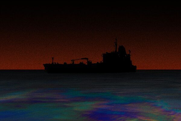
SkySat Image of Ships Bunkering
In an era of increasing AIS manipulation and “shadow fleet” activity, what you don’t see can cost you.
While most vessels have nothing to hide, those concealing their locations to evade sanctions or hide illicit trade pose regulatory and financial risk for commercial operators.
Use Cases
Remove Blind Spots With Near-Daily Monitoring That Can't be Spoofed
Monitor vessels even when they go dark, so you can make better decisions with timely, reliable information.
Verify Asset Locations and History
Know where vessels are and where they’ve been so you can reduce risk exposure and improve reliability of operations.
Ensure Compliance
Identify ships that enter sanctioned areas, maintain compliance reporting, and prevent future risky behavior.
Detect Illegal Activity
Monitor vessels even when they attempt to conceal their locations to spot ship-to-ship transfers, route deviations, and other suspicious activities.
Mitigate Supply Chain Disruptions
Quickly detect and respond to emerging situations with timely, reliable information.
Explore how Planet helps defense and intelligence agencies detect and respond to maritime threats.
Planet Solution
Maritime Domain Awareness
Maritime Domain Awareness
Our solution delivers unmatched coverage of the Earth’s waters paired with AI-enabled vessel detection and integration with other maritime datasets. Near-daily data helps monitor rapid changes and improve compliance, protect against insurance fraud, and maintain the physical safety of crews and cargo.

Learn more about Planet Vessel Detection
Read the solution brief to find out how Planet Vessel Detection can help modernize MDA at your organization.
Solution benefits
Proactive Maritime Monitoring
Unmatched Coverage
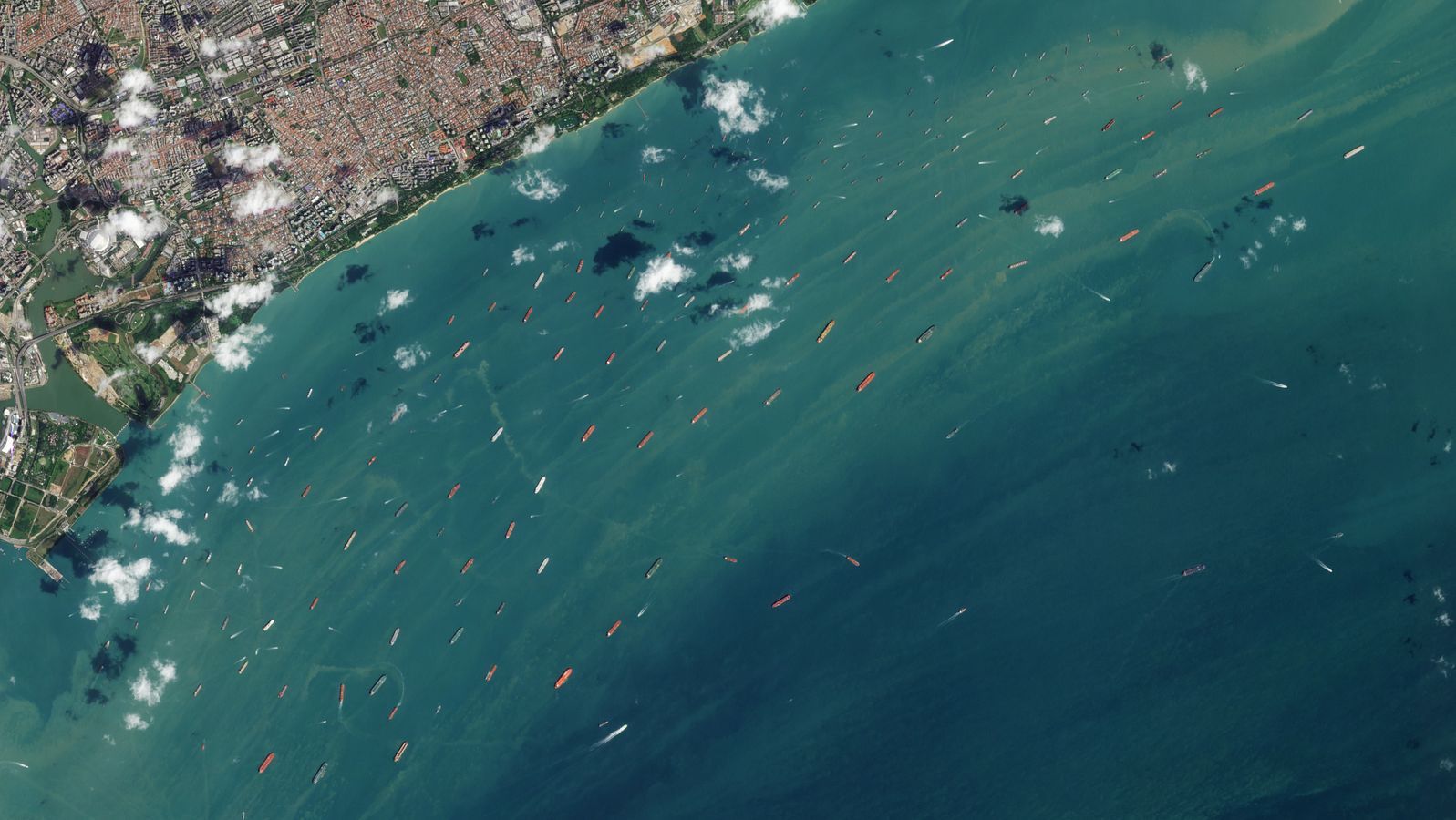
The PlanetScope® constellation delivers near-daily 3.7 m imagery over 20 million sq km of open water, covering strategic regions like the South China Sea, the Persian Gulf, and other high-risk corridors.
For illustration purposes only,
collected areas are subject to change.
Automatic Vessel Detection
Automated Vessel Detection feeds use deep learning to detect ship to ship transfers and identify and classify vessels (cargo, tanker, military, etc.), providing location, heading, and confidence scores.
Understand Patterns and Trends
Leverage an extensive archive with proprietary datasets going back to 2009 to understand patterns of life, detect anomalies, and risk profiles for vessels and routes based on past activity.
Combine Maritime Datasets for Advanced Analytics
Integrate imagery and vessel detections with AIS and other data sources in your own MDA platform or using Theia, our preferred MDA partner solution (provided by SynMax), to unlock advanced analytics, including dark vessel detection, path prediction, and more.
News from Planet
Maritime Mapping, Monitoring, and More: View Global Waters with Planet
Resources
Resources

Ready to Eliminate the Blind Spots in Your Maritime Picture?
Better data leads to better decisions. Let us help you gain the strategic advantage you need to prepare for, deter, and respond to maritime risks.
© 2026 Planet Labs PBC. All rights reserved.
| Privacy Policy | California Privacy Notice |California Do Not Sell
Your Privacy Choices | Cookie Notice | Terms of Use | Sitemap
