Damage Assessment Data and Environmental Impact Monitoring
Planet Solutions for Disaster Management
SURVEY DAMAGE ACROSS BROAD OR REMOTE TERRAIN
Accelerate response time, improve resource allocation, and guide restoration efforts
Rapidly assess damage and support long-term relief and recovery efforts with Planet high-spatial and temporal satellite data and analytics.
CONTINUOUS AND HIGH-RESOLUTION IMAGERY
Improve efficiency of search and recovery and accelerate aid
Planet provides time-sensitive insights on where the impacts to people and property are highest priority.
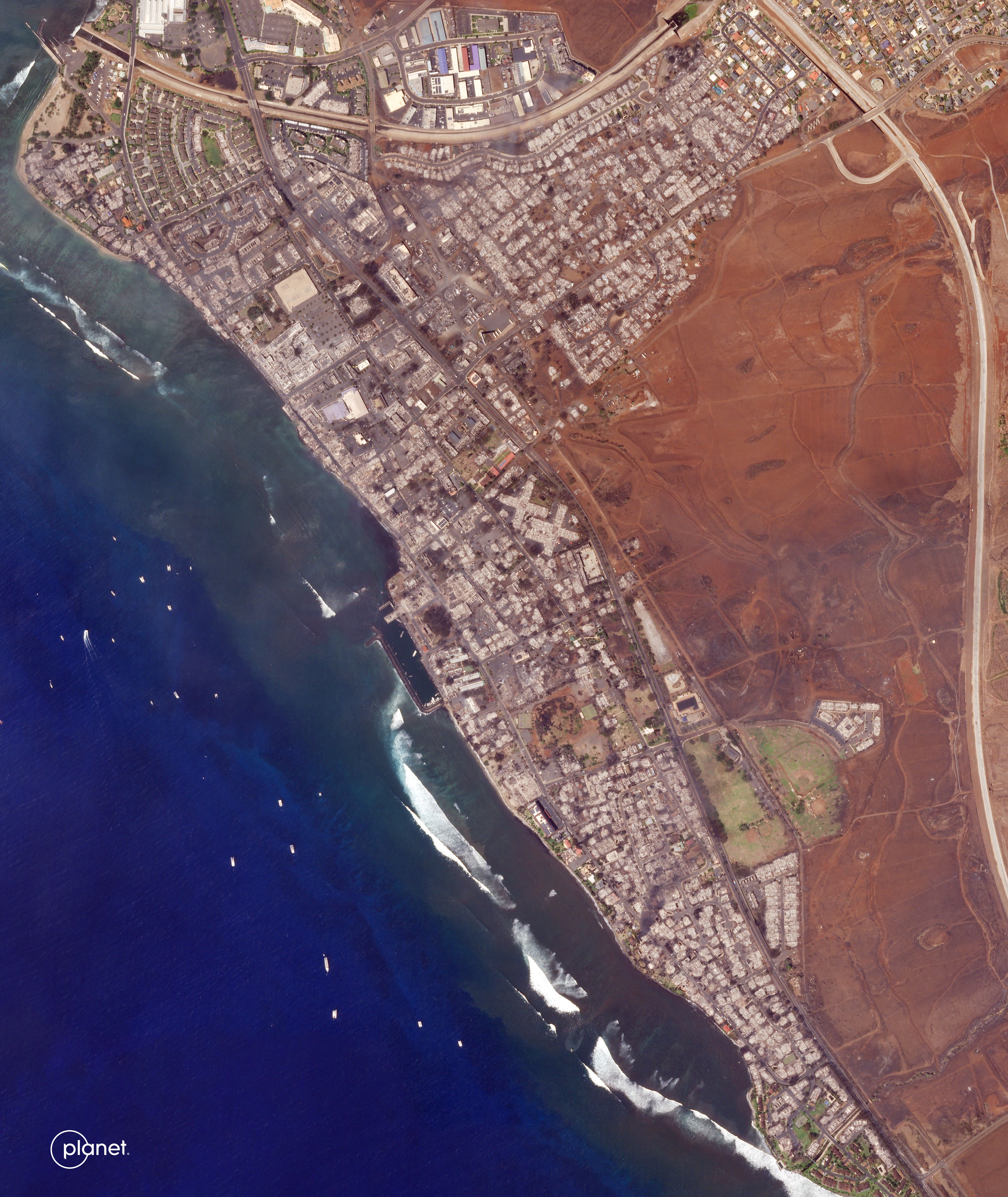
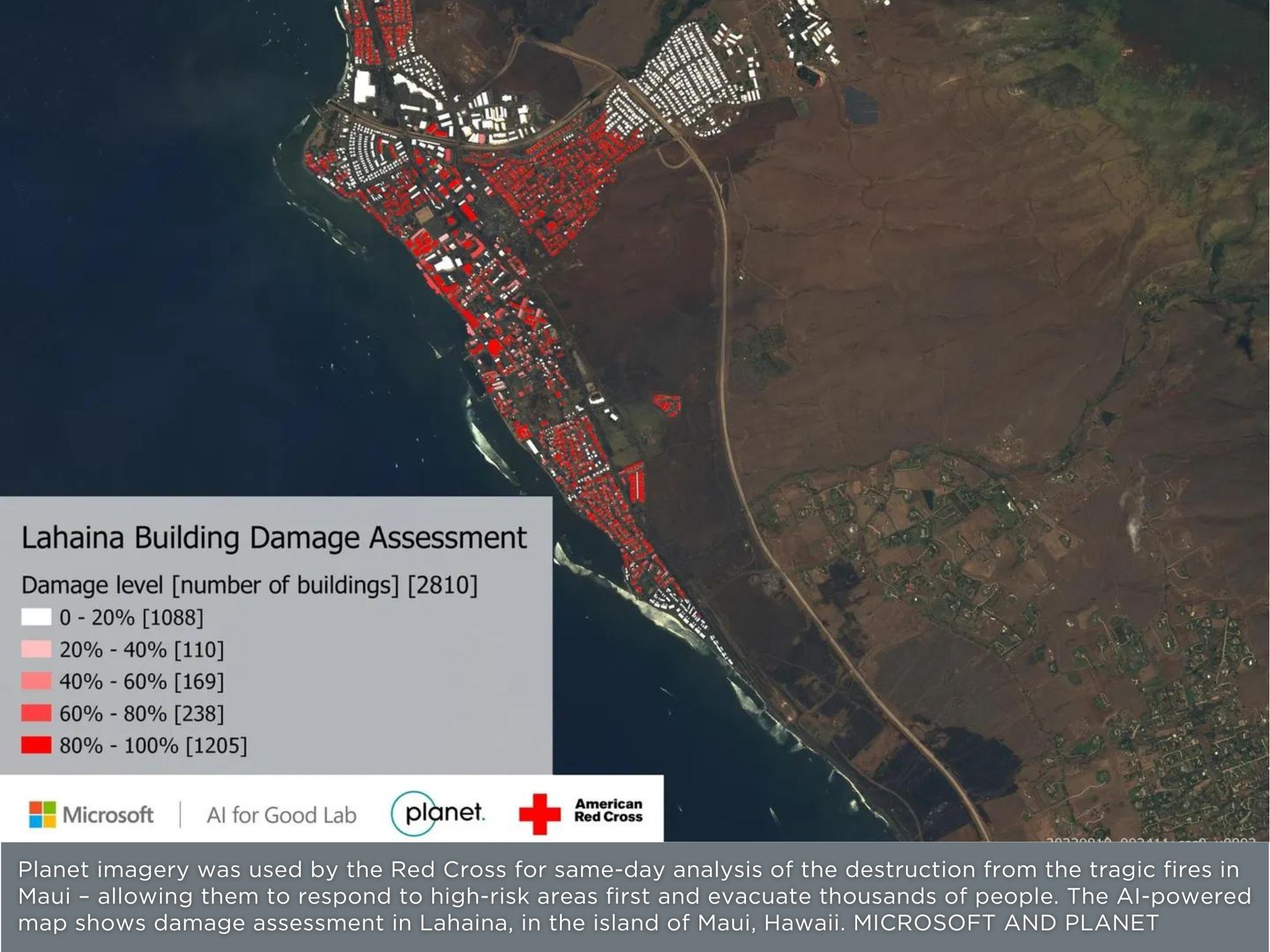
Forbes News Story: Maui Fires Building Damage Assessment
HIGH-FREQUENCY REMOTE SENSING
Access insights across inaccessible landscape
Analysis ready, near-daily satellite data, and extensive archive offer timely insights - no matter the location on Earth.
Disaster intelligence at scale: Learn how McKenzie Intelligence Services uses Planet data to help assess natural disasters and accelerate decision-making.
DATA AND ANALYTIC SOLUTIONS
Improve risk models for future events
Planet’s fleet of medium- and high-resolution satellites, dynamic archival data, and AI-powered insights help generate accurate risk models to mitigate future disasters.
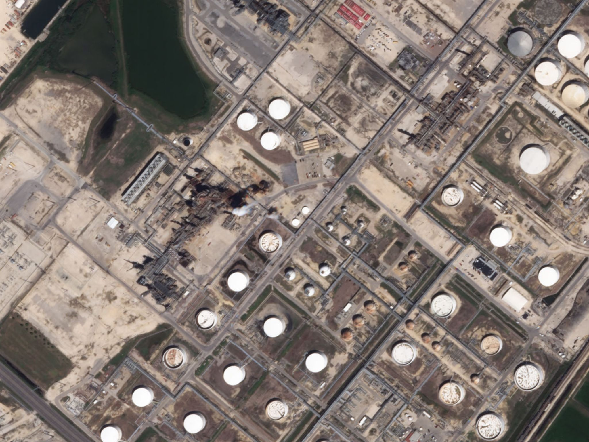
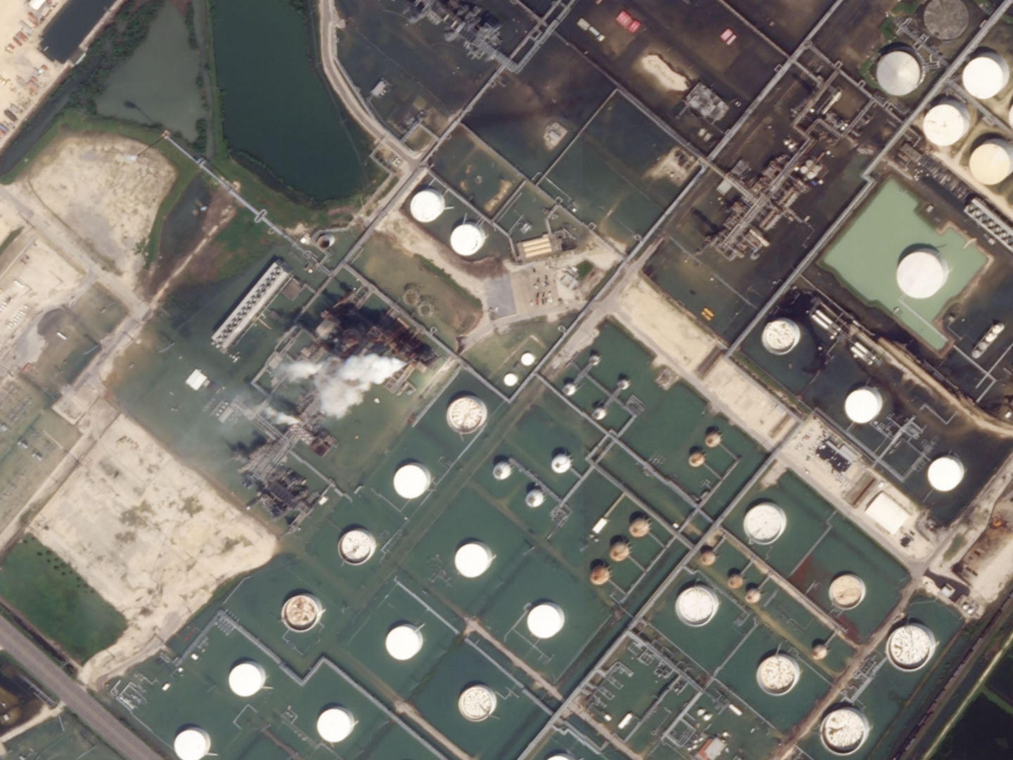
Learn how Planet imagery helped assess Hurricane Harvey’s impact on Houston.
ENVIRONMENTAL IMPACT MONITORING
Visualize changing conditions to land, water, and ecosystems with data-driven comparisons
Track and analyze environmental impacts from sudden or perpetual disasters at a high spatial and temporal resolution.
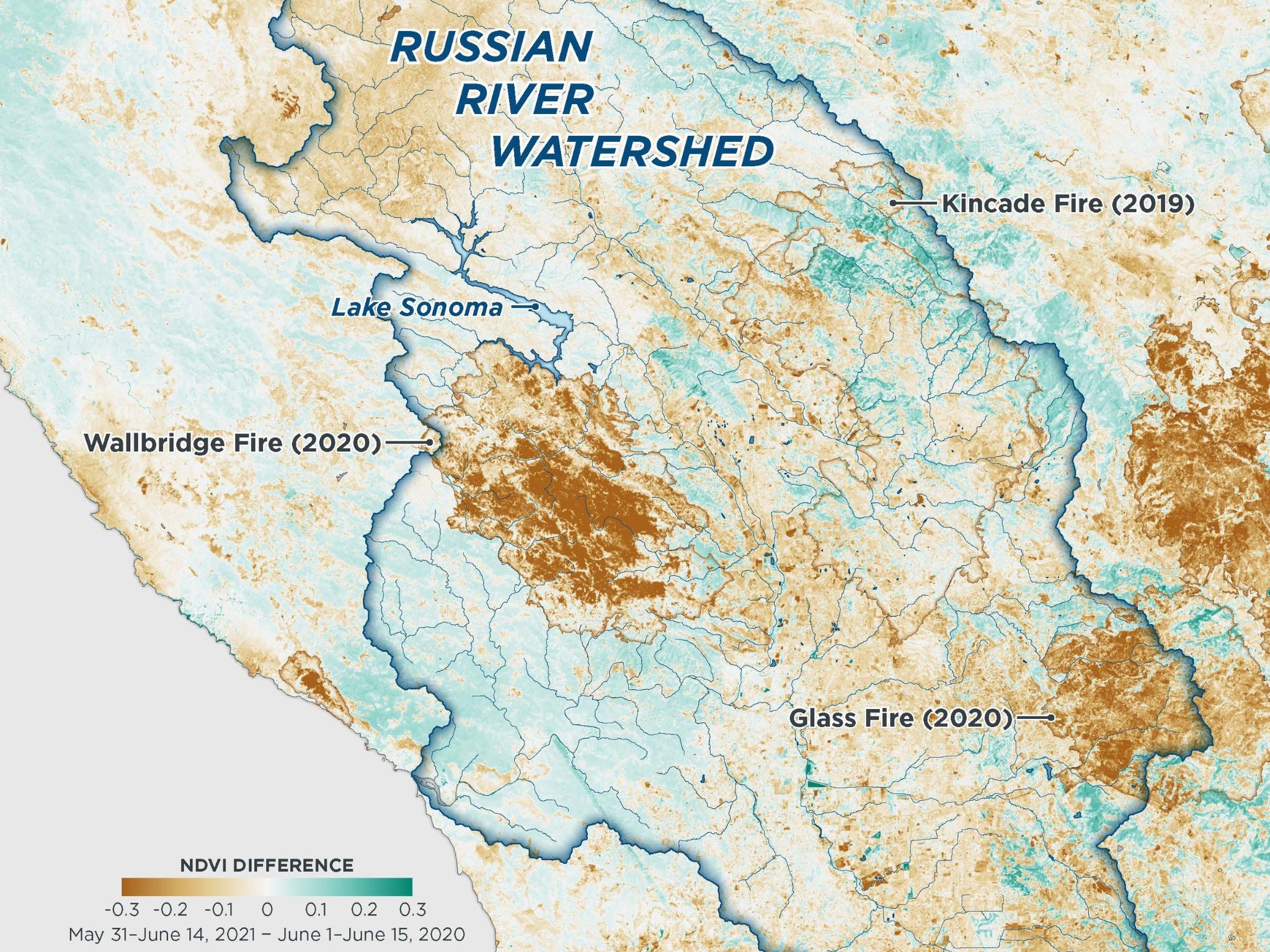
Measuring vegetation density to analyze drought: Planet Basemaps and normalized difference vegetation index (NDVI) values can be used to understand and respond to unprecedented climatic conditions.
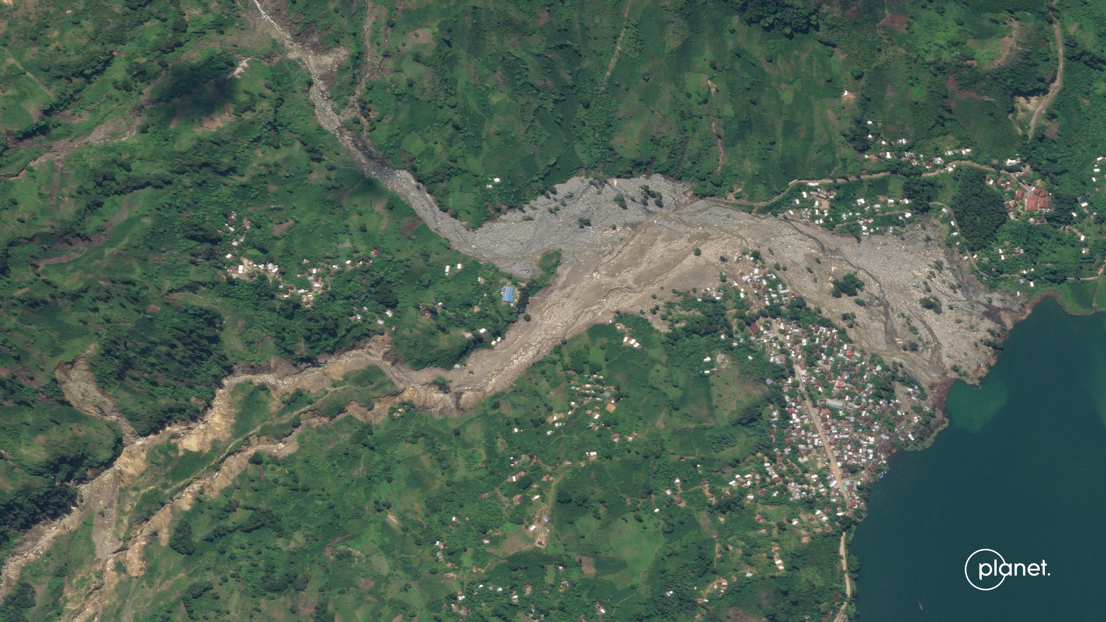
When we heard about the landslide we were able to access Planet imagery immediately. The timeliness and availability of this image allowed us to assess the extent of the landslide and take action.

Harold Bryan S. Paler
Senior Science Research Specialist at the The Philippines Department of Science and Technology, Advanced Science and Technology Institute (DOST-ASTI)
Get in Touch
Interested in learning more? Reach out to your account executive or contact our team.
© 2025 Planet Labs PBC. All rights reserved.
| Privacy Policy | California Privacy Notice |California Do Not Sell
Your Privacy Choices | Cookie Notice | Terms of Use | Sitemap
