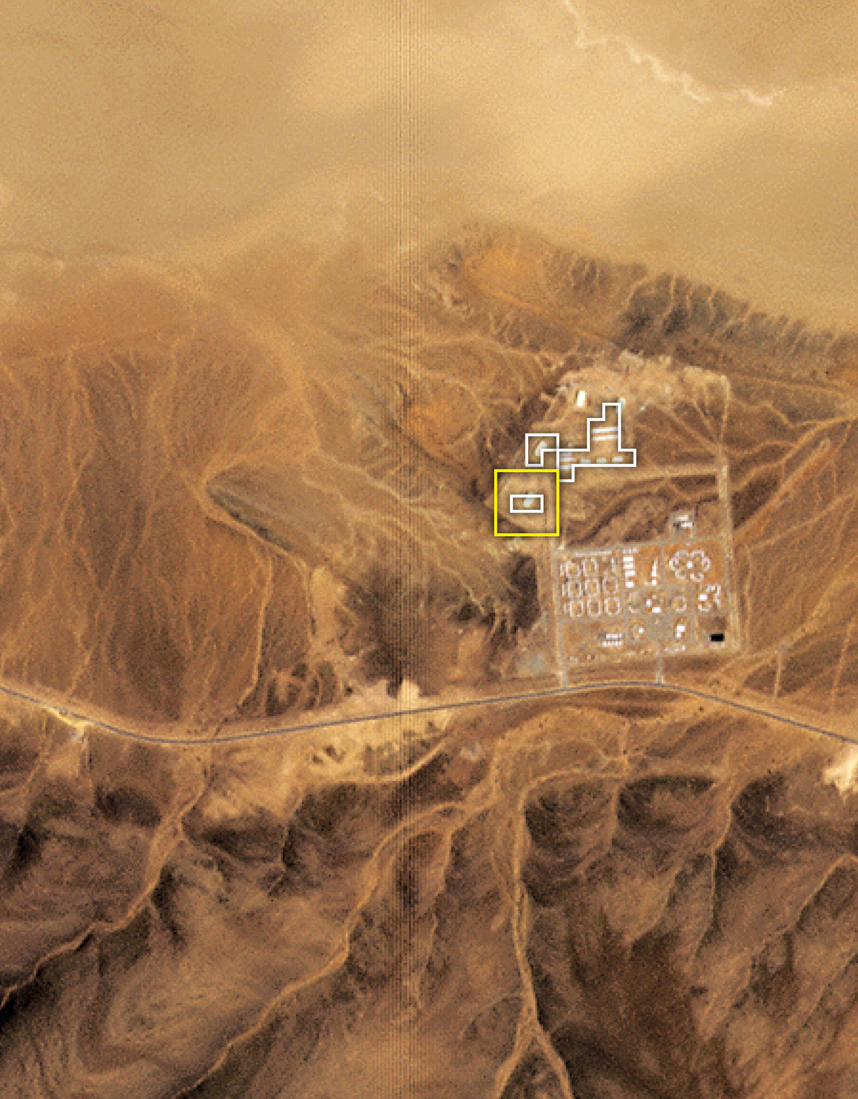
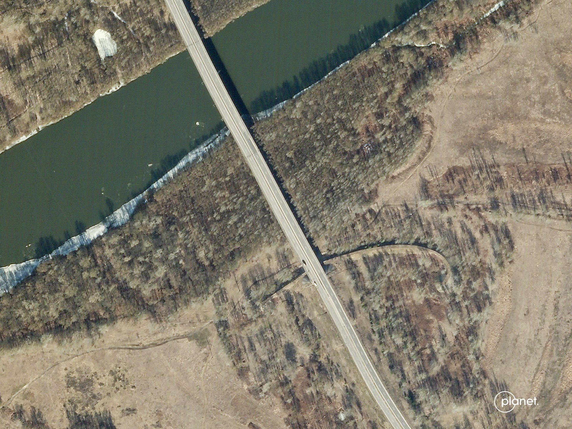
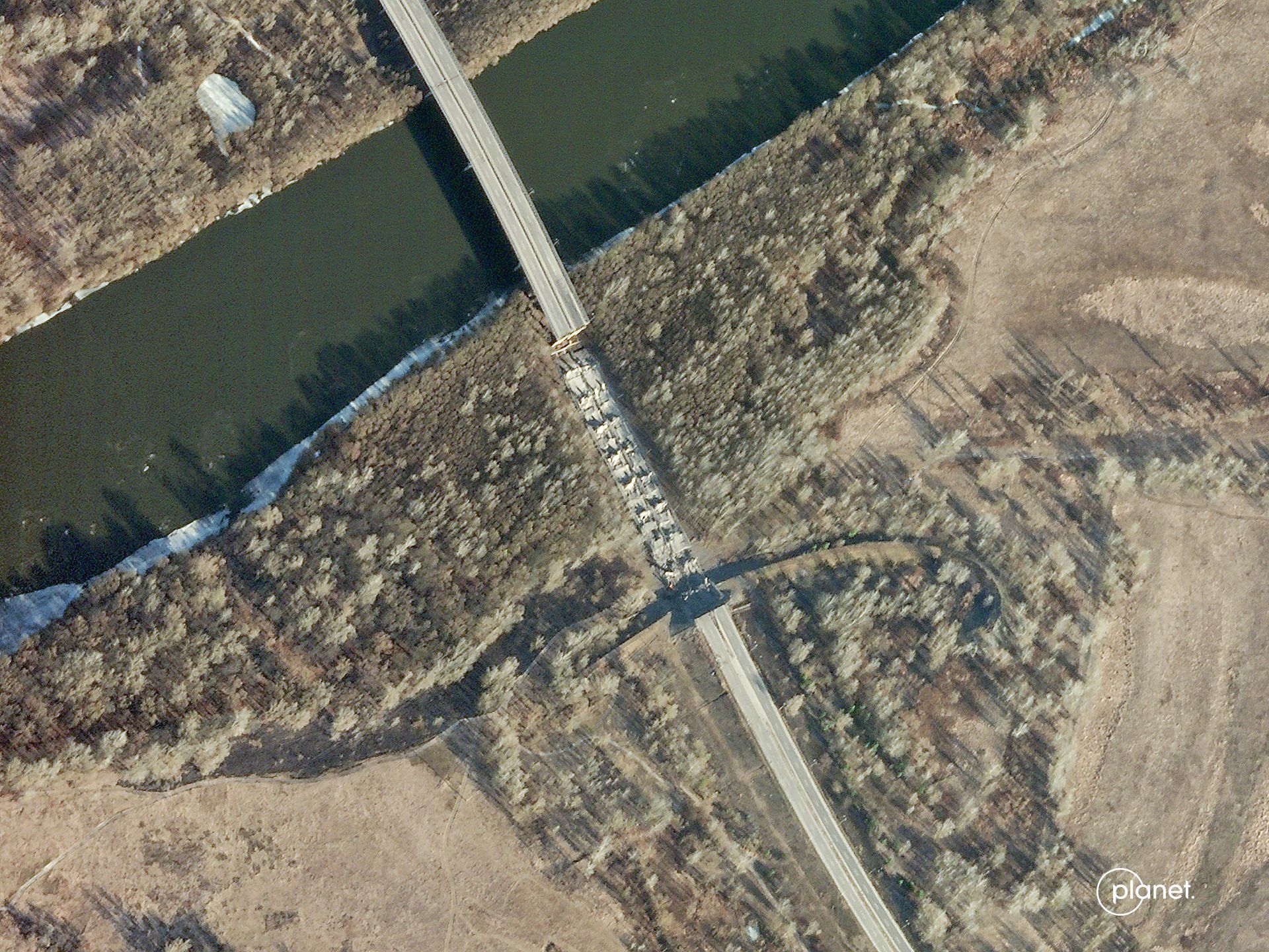
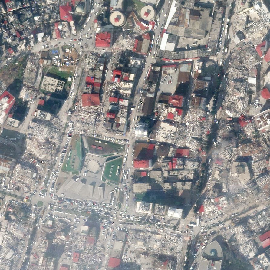
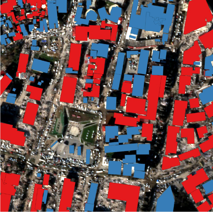
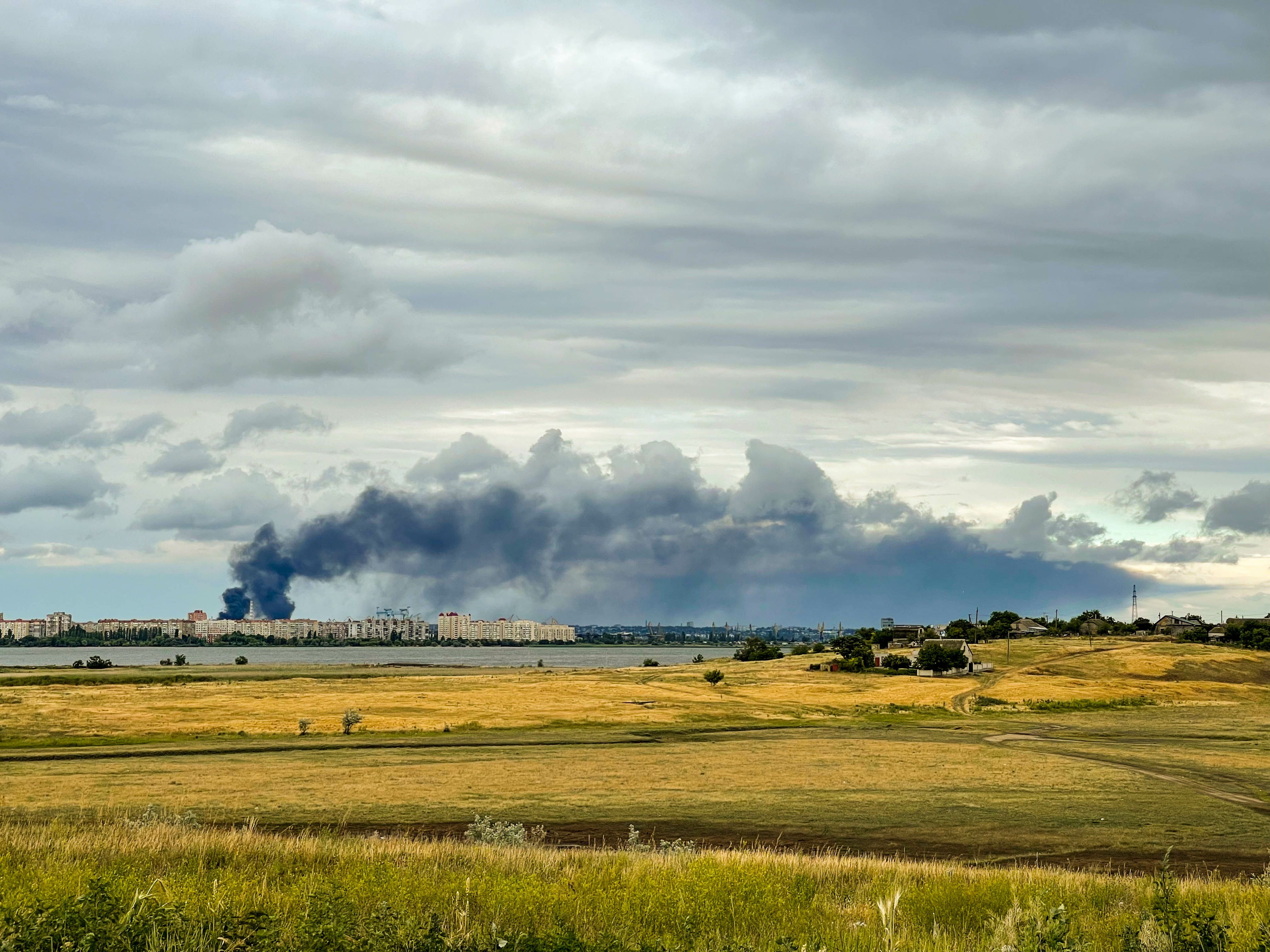
Improve the speed, accuracy, and safety of your mission with near real-time satellite imagery, change detection alerts, and high-resolution tasking.
Whether you’re monitoring emerging hazards or planning urgent operations, Planet provides quick access to the data you need.
Scroll to discover a small collection of images that have had a big impact.
October 12, 2021 - December 29, 2021 | Yelnya, Russia
This pair of high-resolution SkySat images shows the buildup of Russian infrastructure and vehicles about 160 miles (260 kilometers) north of Ukraine.
PlanetScope daily monitoring and high-resolution SkySat tasking improved situational awareness on the ground and acted as a source of truth to counter misinformation online.
February 23, 2022 | Mediterranean Sea
Satellite imagery shows the Russian Navy as they sailed in the Mediterranean Sea. External analysis of the fleet’s formation was conducted to understand the type and number of vessels in the group as they sailed in the direction of Syria.
Over the course of the crisis, PlanetScope imagery has been used for vessel detection analysis to enhance maritime domain awareness.
February 27, 2022 | Belgorod Oblast, Russia
External intelligence researchers used Planet imagery to identify likely sources of Russian missile attacks. The plume of smoke rises from what analysts determined to be a probable Multiple Launch Rocket System (MLRS) oriented in the direction of Kharkiv.
OSINT tools have created a virtual environment where information is readily available to both decision-makers and the public.
March 2022 | Borodyanka, Ukraine
Planet worked with the United Nations Operations and Crisis Center (UNOCC) and Microsoft’s AI for Good Lab to assess the extent of structural damage caused by the war. The analysis identified affected schools, hospitals, and sanitation facilities.
This information can support the scale and speed needed for ground teams to respond effectively.
June 5, 2002 | Sevastopol, Ukraine
Planet enables analysts to conduct advanced maritime vessel detection and tracking.
External investigators reported an alleged laundering system of grain stolen from Ukraine by analyzing SkySat images of multiple vessels as they were loaded in port. They were then observed conducting ship-to-ship transfers out at sea while “dark.”
July 2022 | Ukraine
Near the frontline of the conflict, fields were left unharvested. NASA Harvest used Planet imagery to calculate yields so governments and organizations could better see crop output, and take appropriate compensatory measures.
This work is now being scaled to conduct agricultural monitoring assessments of potential threats to global food security.
Planet imagery has proven critical to intelligence, surveillance, and reconnaissance (ISR) missions throughout the conflict in Ukraine through rapid satellite tasking and information downlink.
Open, shareable data and the urgency of the conflict has catalyzed technology and humanitarian solutions that will have positive, global implications beyond this war.
Learn more about Planet capabilities and other security use cases to improve real-time situational awareness.
Extend
Increase cadence, coverage, and resilience of data
Enhance
Boost pace, scale, and capacity of workflows with tip and cue
Augment
Achieve new insights to inform policy and planning
EXTEND your imagery collection
Our in-depth historic archive compliments daily capture. See how national security customers leverage high-resolution tasking and always-on monitoring to respond to events as they unfold.
Learn how Planet imagery was critical to:
SkySat • Desna River Bridge, Ukraine • February 26 - 28, 2022
PlanetScope + SkySat • Spratly Islands, South China Sea
September 4, 2020, September 22, 2020, December 24, 2020
ENHANCE your existing workflow
Lower the risk of missing critical events with activity-based signals.
Government agencies use change detection and tip and cue automation to reduce processing bottlenecks, freeing analysts to qualify and evaluate key changes on the ground.
See how PlanetScope imagery helped:
AUGMENT your research capabilities
Planet customers and partners have augmented capabilities when they combine satellite imagery with machine learning and artificial intelligence.
This enables governments to respond to events with rapid analysis — and inform policy and planning.
Learn how Planet assisted Turkey’s Ministry of Interior Disaster and Emergency Management Presidency (AFAD) to assess building damage and inform rescue operations in Turkey following the 7.8 magnitude earthquake.
Skysat • Marash, Turkey. February 9, 2023. UC Berkeley, the US Department of Defense Innovation Unit, Maxar, Microsoft AI for Good Lab and Microsoft Philanthropies
RESILIENT CONSTELLATIONS MEAN RELIABLE DATA
The Planet agile aerospace fleet provides a diversified collection of imagery and communication paths.
With hundreds of medium-resolution SuperDoves and approximately 20 high-resolution satellites in orbit, our process to build, launch, and replenish our fleet is fast and economical.
PlanetScope
RGB and NIR bands, 3.7m spatial resolution, captured by Planet’s Dove constellation
SkySat
RGB, NIR, and pan bands, 0.5 spatial resolution
© 2023 Planet Labs PBC. All rights reserved.
| Privacy Policy | California Privacy Notice |California Do Not Sell
Your Privacy Choices | Cookie Notice | Terms of Use