Search

Planet Products
Planet Insights Platform brings together Planet’s global daily Earth data, derived data products, and powerful cloud-based tools in one place. So you can supercharge your workflows with a dynamic, multidimensional view.
Whether you’re an analyst, data scientist, or developer, Planet Insights Platform will help increase observability across your operations, enhance the performance of your teams, and scale your products and services with daily Earth insights.
Everything you need to make change happen, at your fingertips.

All in one, good for all
Planet Insights Platform is the central place where daily Earth data, analytics, and powerful tools are combined to achieve the insights that characterize our changing physical Earth.
Our platform brings together Planet’s flagship Monitoring, Tasking, Analytics, and Planetary Variables product suite – supercharged with the recently acquired Sentinel Hub – to offer a more unified experience for a broad set of users.
Planet Monitoring
Observe vast geographic areas, discover patterns, and identify changes over time. Powered by hundreds of Dove™ satellites in orbit, Planet provides high-frequency data that strives to cover the landmass of the Earth each day, empowering you to make timely, informed decisions across broad areas.
Learn More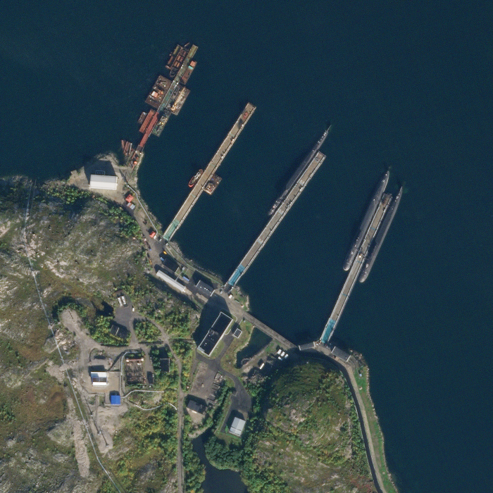
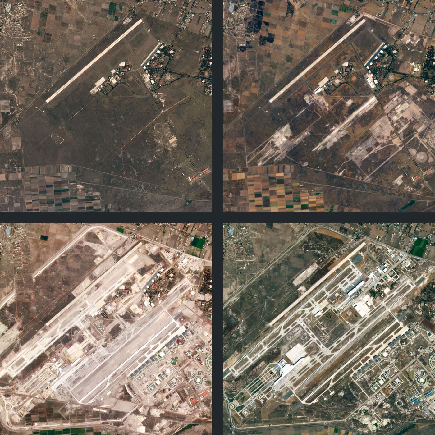
Planet Tasking
Get site-specific data to characterize change in closer detail. SkySat® imagery provides real-time intelligence through very-high-resolution imagery, so you can proactively identify blind spots, anticipate events, and have confidence in your next mission-critical decision.
Learn More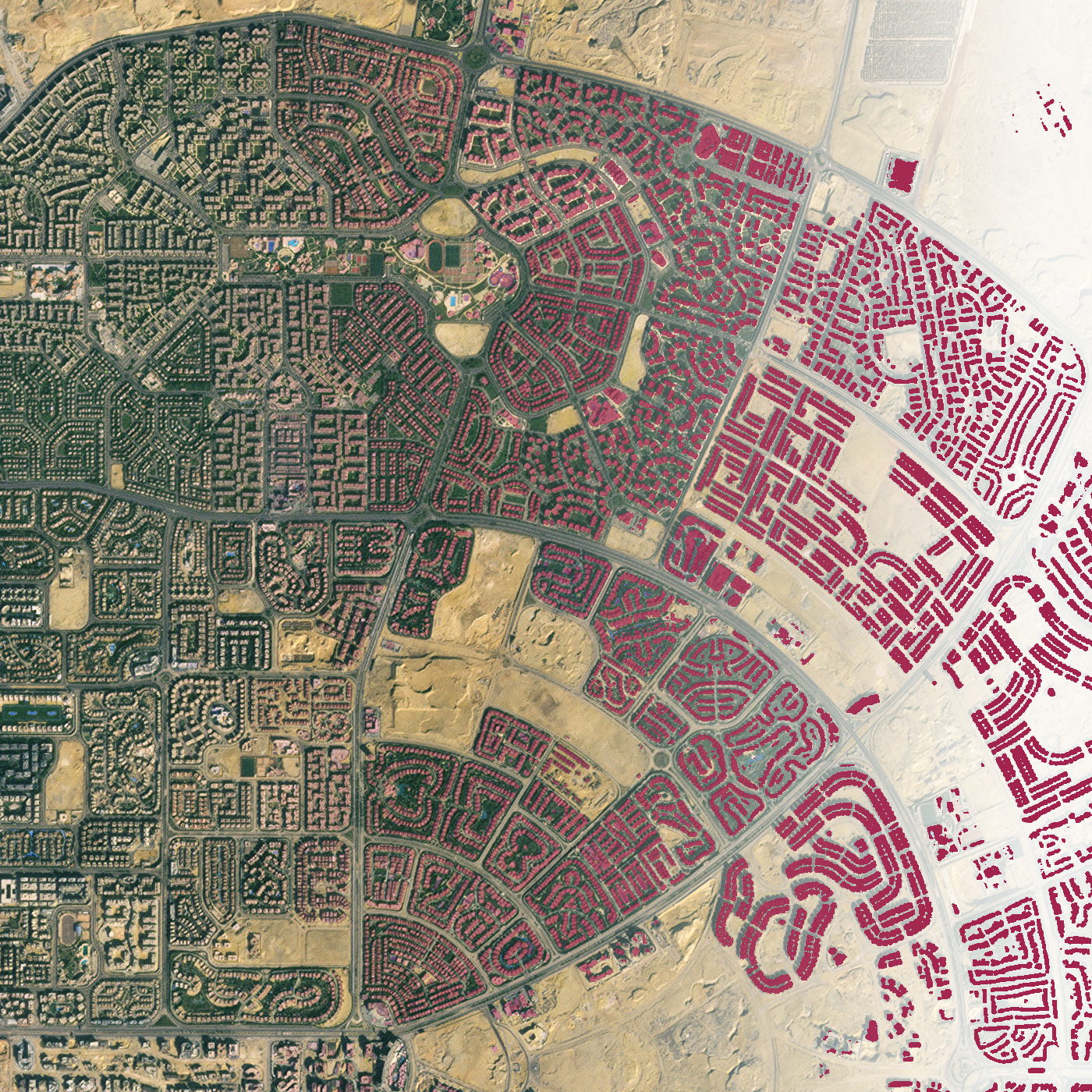
Analytic Feeds
Leverage machine learning to automatically identify objects and features of interest from Planet’s deep archive of data at global scale, empowering you to prioritize resources and act with the most recent insights available.
Learn More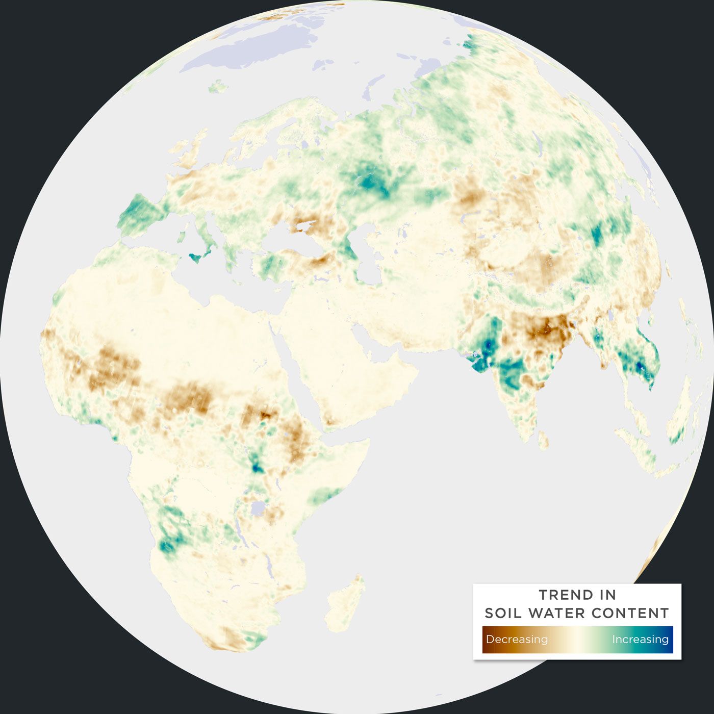
Planetary Variables
Access continuous, scientifically rigorous data that measures the changing conditions of the surface of the Earth – drawing on observations from Planet’s satellites and the broader Earth observation ecosystem.
Learn More
Planet Basemaps
Gain insights over broad areas and diverse geographies, and harness time series, analytics, and visualizations. Our cutting-edge software meets daily global satellite imagery to create visually consistent and scientifically accurate mosaics.
Learn MoreRead More
How others are using Planet products
© 2025 Planet Labs PBC. All rights reserved.
| Privacy Policy | California Privacy Notice |California Do Not Sell
Your Privacy Choices | Cookie Notice | Terms of Use | Sitemap
