Search
Measuring Wildfire Effects on Lahaina
Journalists and researchers used Planet imagery to visualize the damage caused by the Lahaina fires of August 2023. Planet's imagery was used in about 20 news articles from outlets like The New York Times, The Washington Post, The Wall Street Journal, NBC, Axios, and CNN, among others.
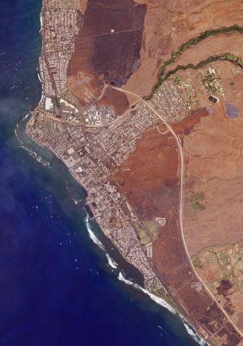
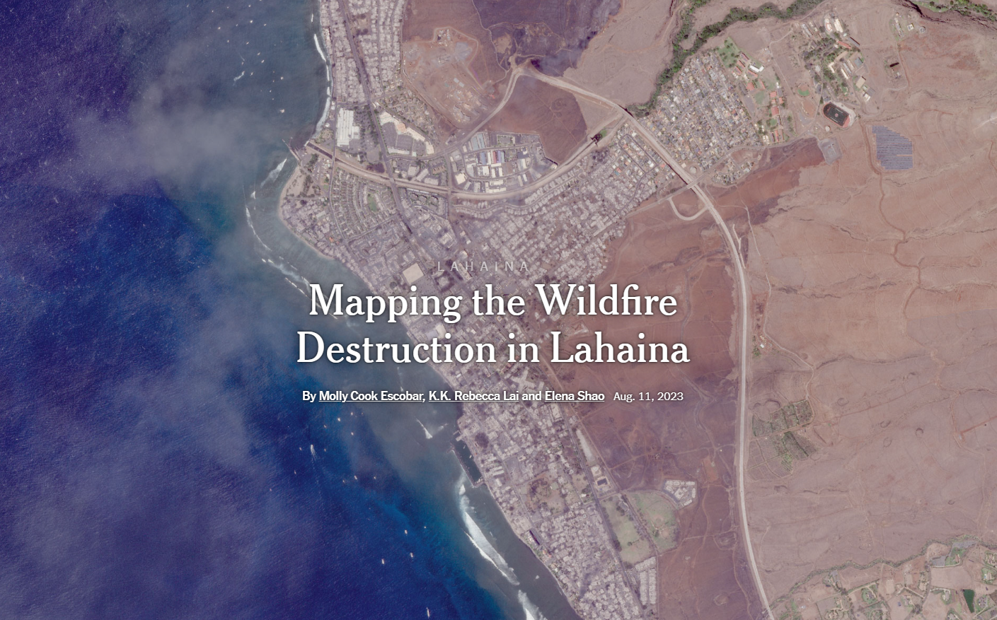
A Planet SkySat image showing the aftermath of the fires in Lahaina.
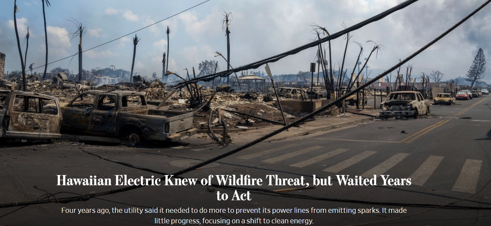
Lahaina is an historic town located on the Hawaiian island of Maui. In August 2023, a devastating wildfire tore through the city, leaving destruction in its wake. Tragically, dozens of people lost their lives. According to a November article from news outlet Honolulu Civil Beat, the death toll of the Lahaina fire reached 100 people.
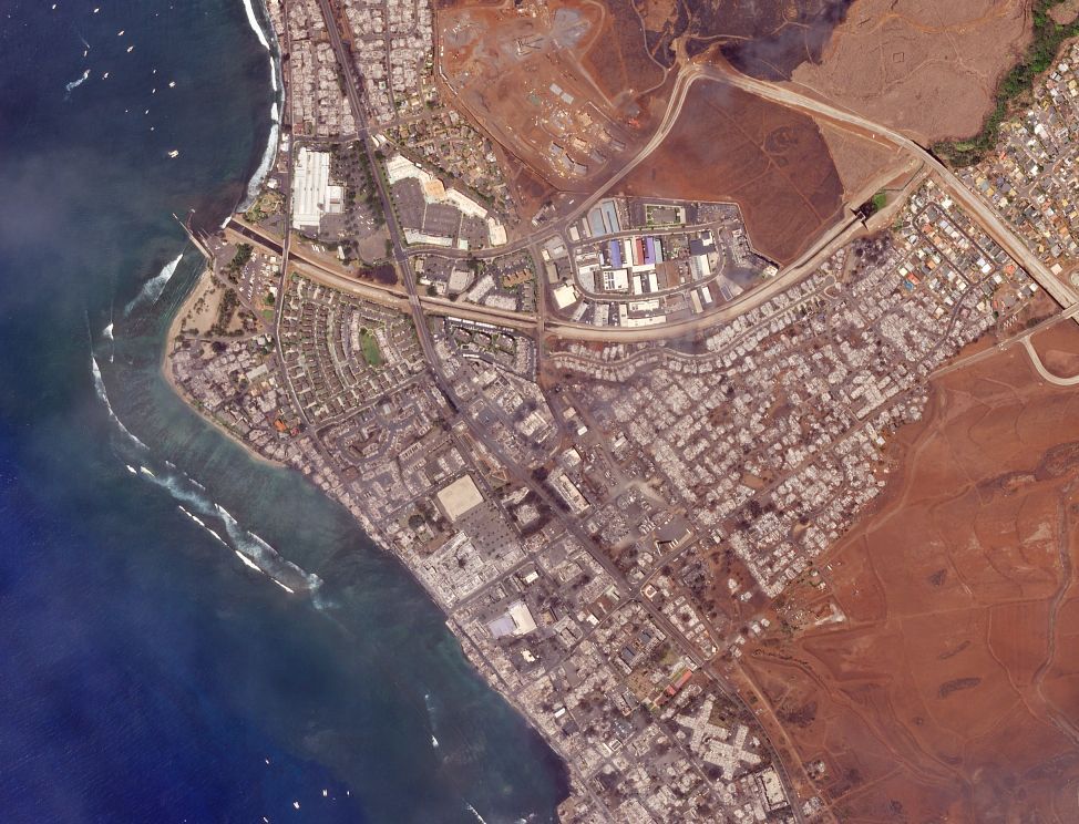
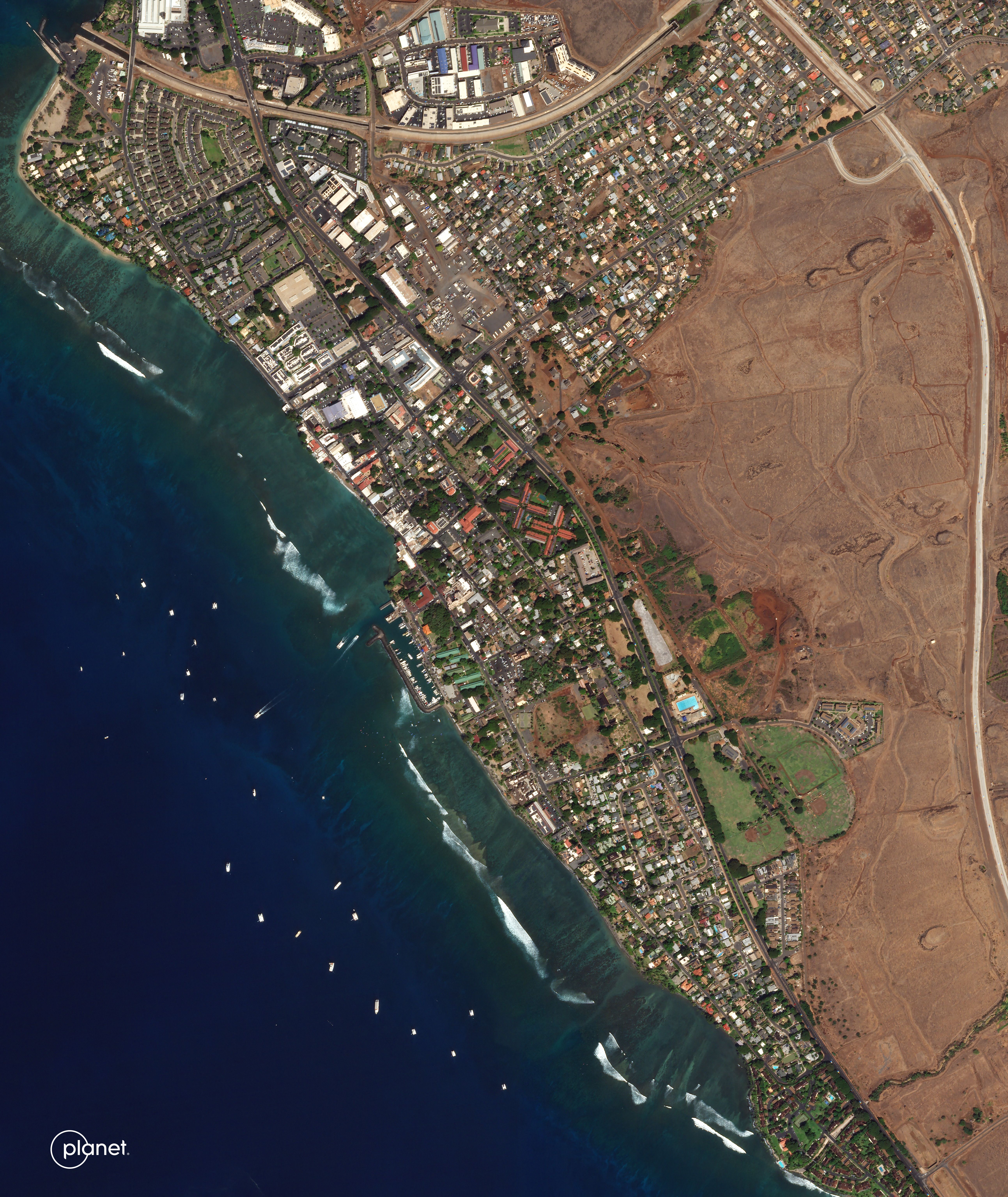
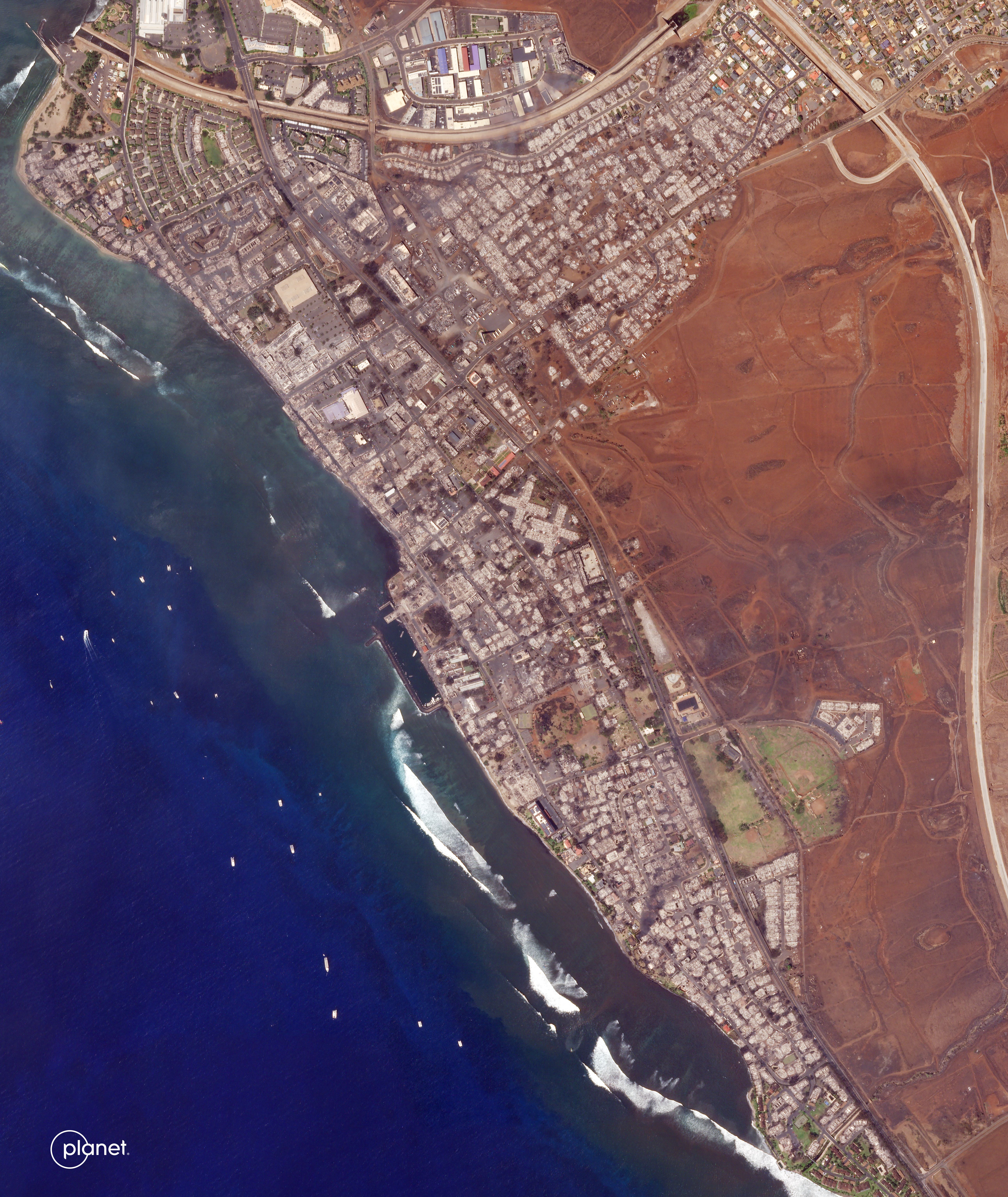
SkySat imagery of Lahaina.
The before imagery (left) was captured on September 15, 2022, and the after imagery (right) was captured on August 9, 2023.
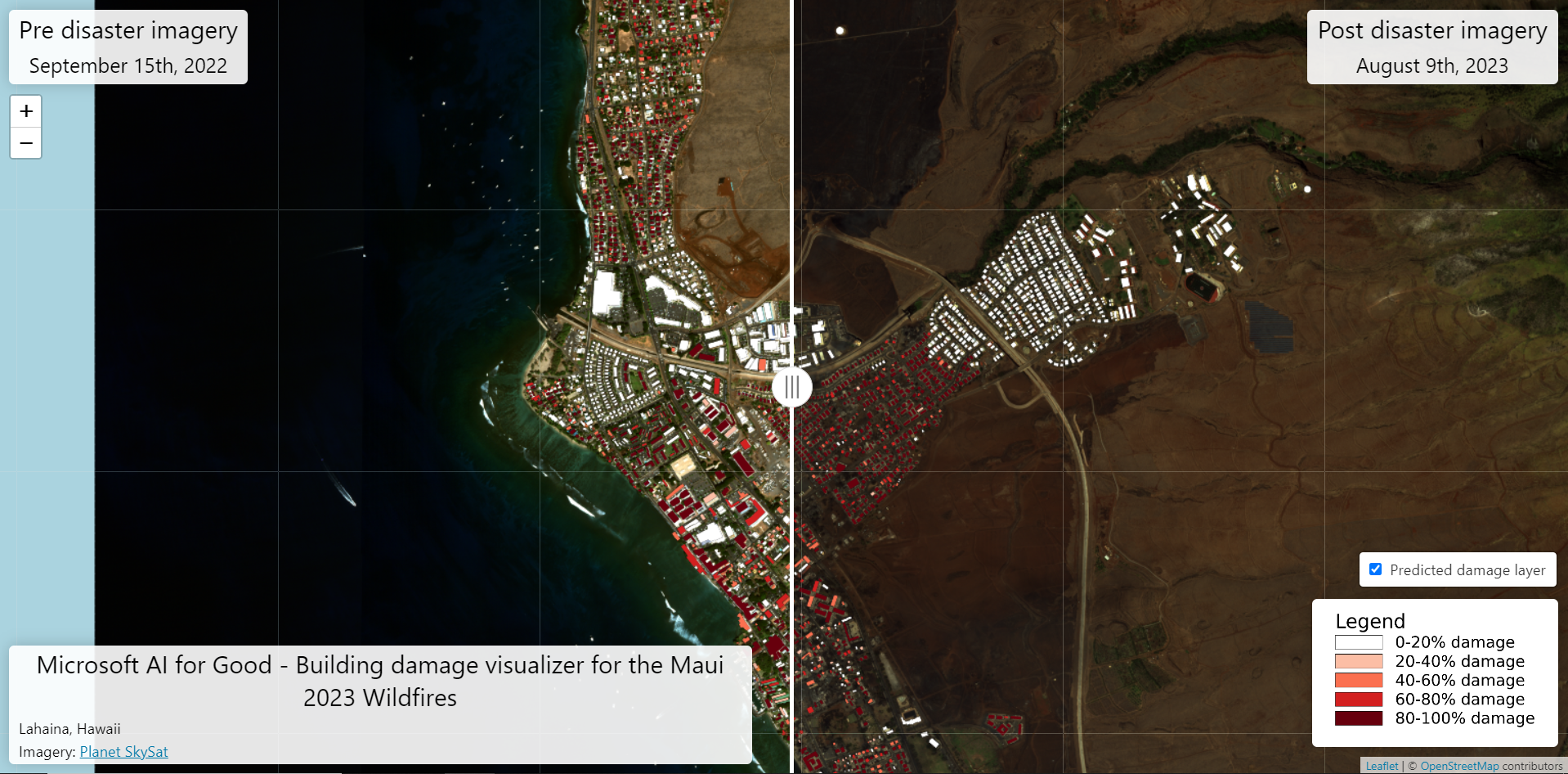
In order to better understand the scope and scale of the fire damage in Lahaina, researchers from Microsoft’s AI for Good Research Lab used a machine learning (ML) model on Planet imagery to analyze building damage. Caleb Robinson, a senior applied research scientist at Microsoft, published a paper with Microsoft colleagues and American Red Cross personnel detailing how the model works. “This paper describes the methodology used. We worked with [the] American Red Cross to respond to the tornado that hit Rolling Fork, [Mississippi,] and followed an identical response with them for Lahaina,” Robinson said.
The visualization below compares pre-disaster imagery from September 15, 2022 with post-disaster imagery from August 9, 2023. The building footprints are colored according to the level of damage that the ML model estimated for each building using the post-disaster imagery from Planet.
A screenshot of a data visualization by Microsoft’s AI for Good Research Lab showing building damage in Lahaina due to the August 2023 fire.
News organizations created building damage assessments using Planet data


If you are an organization seeking access to Planet imagery for research, use the form below to contact us.
Get in Touch with Planet
We love meeting people from around the world. Reach out so we can connect.
© 2025 Planet Labs PBC. All rights reserved.
| Privacy Policy | California Privacy Notice |California Do Not Sell
Your Privacy Choices | Cookie Notice | Terms of Use | Sitemap
