Search

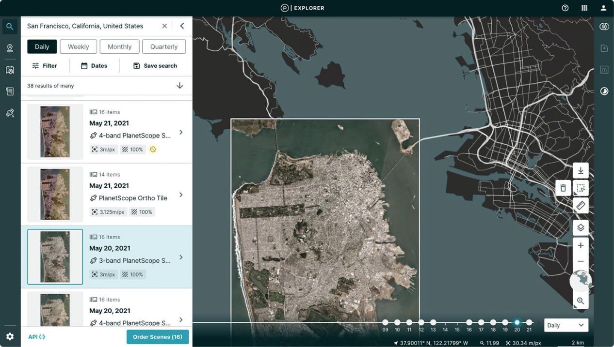
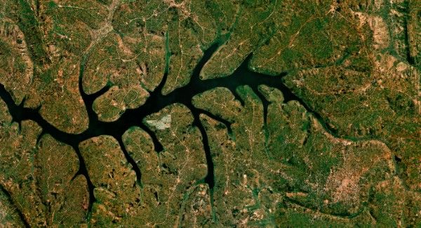
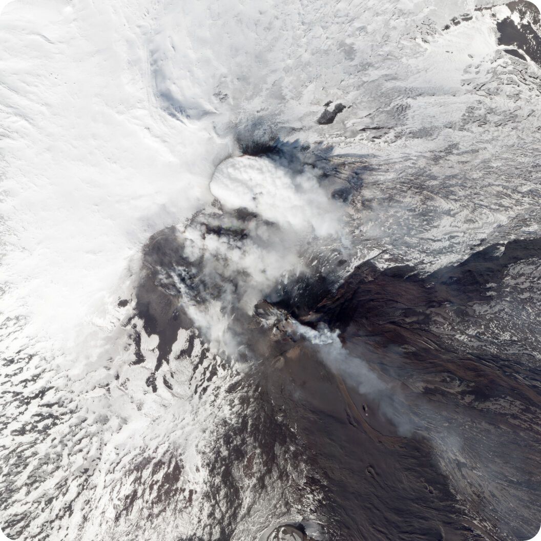
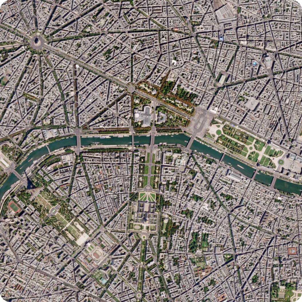
Real-Time Satellite Monitoring with Planet
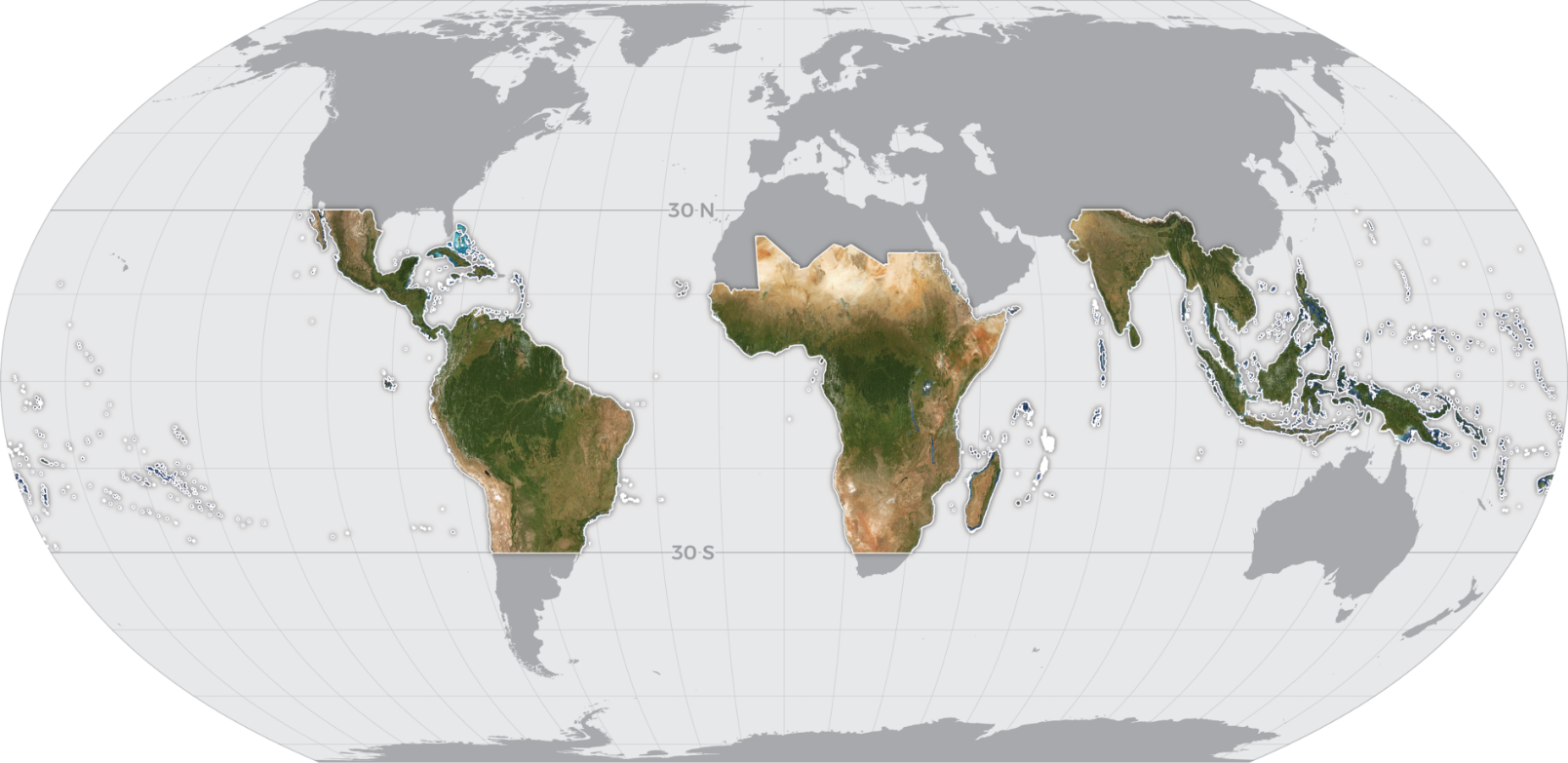
With hundreds of Dove satellites in orbit, PlanetScope® Monitoring provides a high-resolution, continuous, and complete view of the world from above, every day.
What It Is
Global Perspective, Daily Insight, and Real-time Analysis with Planet’s Satellite Monitoring
With Planet Monitoring observe areas of geographic interest, discover patterns, track infrastructure, and identify changes as they happen. From space, Planet Monitoring equips you with ground-truth data you need to make timely, informed decisions.
High Resolution
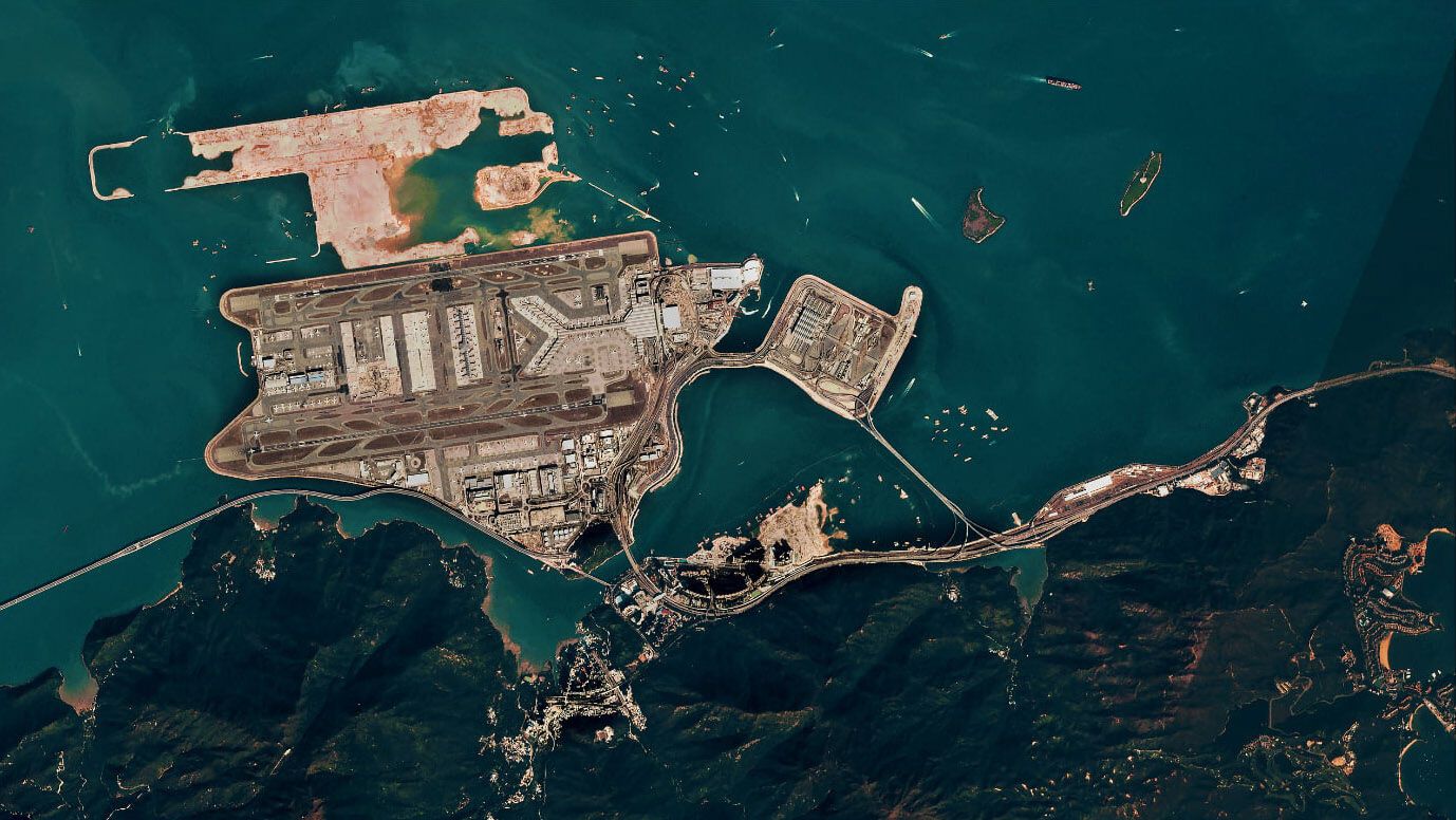
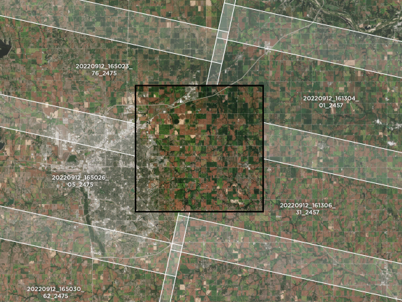
3.7 meter resolution images in four multispectral bands: RGB and Near Infrared
Image Library
Extensive archive of high-resolution images dating from 2009
Global Coverage
Over 300 million square kilometers of imagery collected each day
Access and Integration
Ready-to-use images and data, integrated simply into your existing workflow
Planet Monitoring provides near-daily, 3.7-meter resolution imagery covering all of Earth’s landmass. Access to these ready-to-use images is made simple with Planet’s APIs, web application, and GIS integrations. Available through a subscription model, Planet Monitoring can be scaled to the requirements of your analysis and application needs.
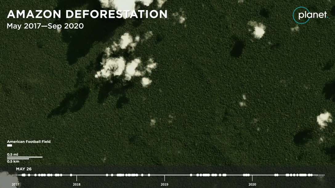
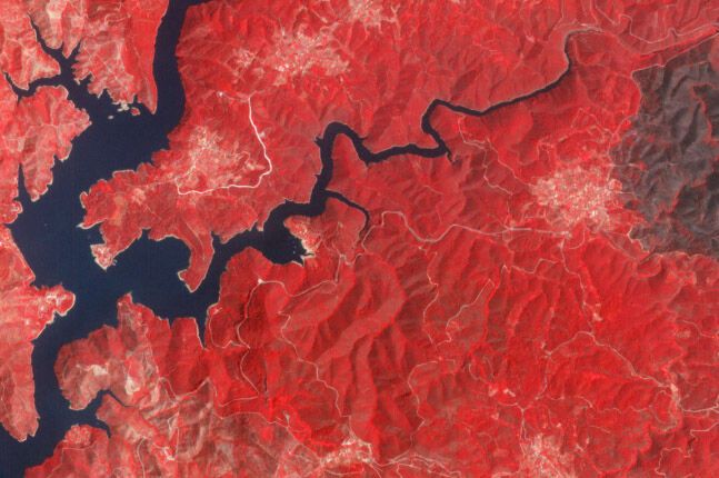
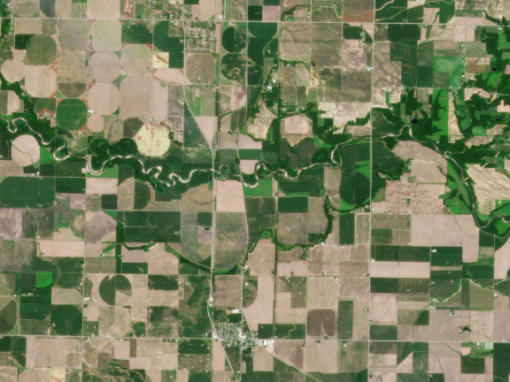
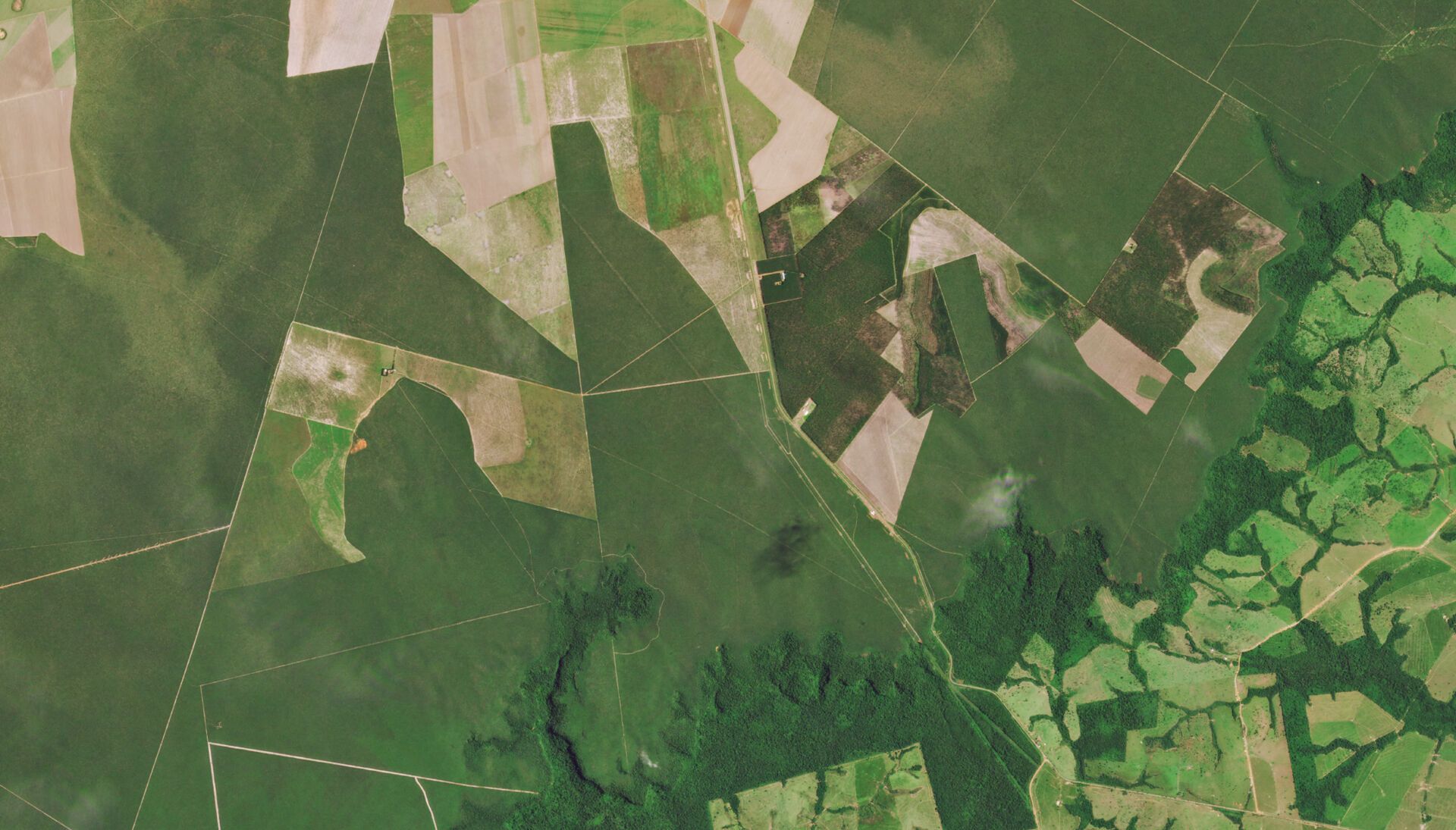
Deforestation in the state of Amazonas, Brazil from 2017 through 2020. Planet’s 3.5 meter data is detailed enough to show the appearance of logging roads and evidence of selective logging, processes that typically occur before full-scale deforestation.
How It Can Help
Satellite Monitoring Provides Crucial and Continuous Information from Space
Planet Monitoring provides a persistent view of land, assets, and operations, from anywhere on earth.
Greater Visibility
Obtain ground-truth data from opaque, dispersed, or remote geographies
More Timely
Hundreds of Doves orbit the planet every 90 minutes, providing near real-time images for time-sensitive monitoring
Continuous Coverage
The PlanetScope Constellation is always on, ensuring constant coverage
Evolution by Design
Improved on-orbit capacity with multiple launches of updated Dove satellites each year
Access and Integration
Ready-to-use images and data, integrated simply into your existing workflow
Planet Monitoring delivers up-to-date insights and satellite images from the areas that matter to you, on a daily basis. With Planet’s growing visual archive, analyze deep stacks of imagery from 2009 until today. Leverage Planet’s global coverage to observe areas of strategic importance at a local, national, and international level. Survey broad areas at scale to identify changes and make timely interventions.
How It’s Used
Identify Change, Inform Action, and Improve Governance with Planet Monitoring
Agriculture
Reliable, up-to-date satellite imagery from Planet Monitoring provides simple and accessible agricultural insights at scale.
- Farm more efficiently, profitably, and sustainably with continuous field coverage
- Gain agronomic insight through field-level detail
- Monitor and analyze field and crop health from preseason to harvest
Ag-Tech companies and farmers alike are looking to new technologies to ensure bountiful crops. Learn how Bayer is leveraging Planet Monitoring to have the right seed, in the right place, at the right time to serve their growers worldwide.


Government
Oversee infrastructure, monitor natural resources, and protect communities from risks using Planet’s continuous monitoring service.
- Manage and monitor infrastructure projects across large landmasses
- Improve protection of natural resources and people
- Analyze geographic areas of interest and derive timely insights
- Monitor and detect illegal changes to land use
Government bodies are using Planet data to address critical governance challenges. Learn about how the New Mexico State Land Office used Planet Monitoring to uncover 53 trespasses which yielded $2.7 million in back payments.
Forestry
Monitor and manage forest assets and operations, track changes in land use and land cover, and localize forest clearing in near-real time with high cadence, high resolution imagery.
- Optimize your timber harvest operations
- Monitor and manage forest health
- Track changes to land cover and land use over time
- Prevent illegal and unpermitted clearing of forest
Learn how Pan Pac automated the collection and reporting on harvested areas by using high frequency, 3.7 meter PlanetScope imagery. This resulted in significant time and cost savings for their team, streamlined workflows for end of month and year-end reporting, and improved data accuracy.
Planet Monitoring Offerings
PlanetScope
Discover patterns, track infrastructure, and identify changes as they happen with near-daily satellite imagery.
What you get:
- Our global coverages sees your entire AOI.
- Act on current conditions with near-daily capture rate.
- Improve analysis with comprehensive multispectral datasets.
Analysis-Ready PlanetScope (ARPS)
Accelerate your analytical workflows with pre-processed, harmonized satellite imagery.
What you get:
- Optimized for temporal analysis with calibrations for sensor differences and atmospheric conditions.
- Harmonized with trusted third-party sources to ensure analytical consistency.
- Ready for analytical models and machine learning algorithms.
Tip & Cue
Planet Monitoring’s near-daily coverage can “tip” analysts off to changes in their areas of interest, enabling them to “cue” Planet’s high-resolution Tasking solutions for an even closer look.
How To Use Planet Monitoring
Planet Monitoring: Simple Access to a Continuous Global Image Dataset
With a Planet Monitoring subscription, you have easy access to the most up-to-date images of your area of interest and an expansive archive.
Planet Monitoring’s global image dataset is updated daily, and dates back to 2009. Delivered in ready-to-use formats, these images are easy to access and order through Planet’s APIs, web applications, and GIS integrations.
STEP 1
Sign Up
Sign up for a Planet Monitoring subscription
STEP 2
Define Parameters
Select your area of interest and frequency of updates
STEP 3
Receive Notifications
Get alerts when new imagery of your areas of interest becomes available
STEP 4
Access Images
Access your pre-processed, analysis-ready imagery via Planet Platform
STEP 5
Integrate into Workflow
Incorporate imagery and data with Planet APIs and GIS desktop integrations
To learn more about Planet’s Daily Imagery, visit Planet University.
Discover More Planet Products
Global Satellite Images and Insights at Your Fingertips
Planet Mosaics
Current, Complete, Analysis Ready
Planet Tasking
Rapid Revisit Satellite Tasking
Planet Archive
A Constantly Refreshed Global Dataset
Read More
Discover How Planet Monitoring Is Increasing Our Understanding of the World, and Improving Life on Earth
FAQs
Learn More About How Planet Monitoring Can Work for You
Ready to Get Started?
Planet Monitoring makes Earth observation simple. Equip your organization with the necessary geospatial information to make critical, informed decisions fast.
© 2026 Planet Labs PBC. All rights reserved.
| Privacy Policy | California Privacy Notice |California Do Not Sell
Your Privacy Choices | Cookie Notice | Terms of Use | Sitemap
