Planet is the leading provider of global, near-daily satellite imagery data and insights. Planet is driven by a mission to image all of Earth’s landmass every day, and make global change visible, accessible, and actionable. Founded in 2010 by three NASA scientists, Planet designs, builds, and operates the largest Earth observation fleet of satellites, providing State and Local governments insights to make the right decision at the right time. To learn more visit www.planet.com and follow us on Twitter at @planet
Planet Can Help Address
Illegal Mining
Water Resources Management
Forest Carbon Monitoring
Compliance with new global export regulations on deforestation and forest degradation
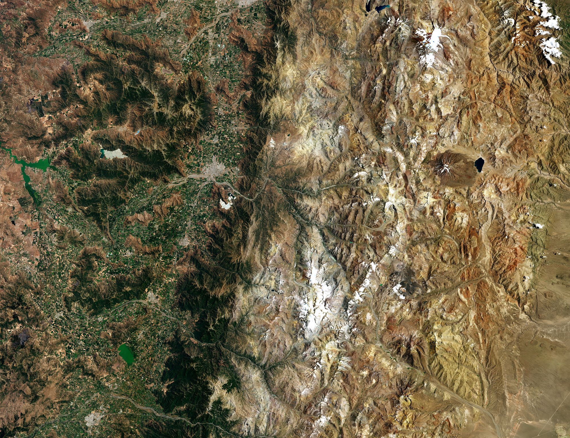
Ensuring Economic Stability And Protecting Natural Resources InChile
Chile’s unique geography poses a challenge for policymakers who need up-to-date, detailed information about ground conditions over vast areas to inform their decisions. Planet's daily global imagery and key remote sensing data support diverse programs across defense, disaster management, and natural resource agencies to help enable faster decisions and data-driven policies.
HIGH-FREQUENCY, COUNTRYWIDE DATA
Planet can provide countrywide, intradaily coverage, which can reduce the need for aircraft or individual resources.
SCALABLE
Planet’s cloud-first APIs allow you to build applications quickly that scale across Chile's various regions.
EASE OF USE
View and download imagery directly in your browser, or integrate with your existing GIS tools.
SUPPORTING COUNTRYWIDE EFFORTS
Planet has collaborated with Chilean government entities, including the National Geology and Mining Service (SERNAGEOMIN), for several years, providing support to emergency services during natural disasters. Furthermore, we actively participate in the National Satellite Service project, supplying HiRes imagery.
Defense and Inteligence
One of Chile's main priorities is to monitor its borders with Argentina, Bolivia, and Peru. For this reason, the Chilean Air Force (FACh), responsible for leading these operations, aims to increase the frequency of high-resolution (HiRes) tasks by utilizing high-resolution satellite images from Planet to optimize its performance.
Emergencies
Chile is affected by numerous natural disasters, such as volcanoes, tsunamis, and earthquakes. In such situations, a more agile response is sought in task allocation to support emergency operations.
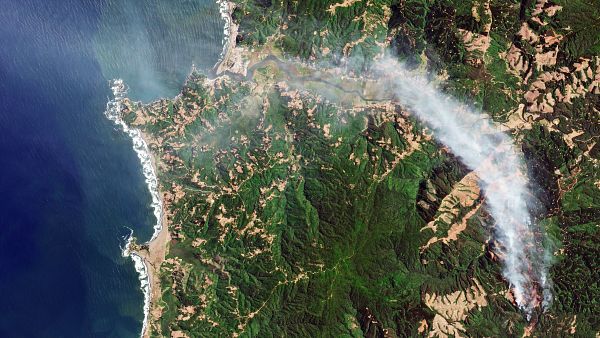
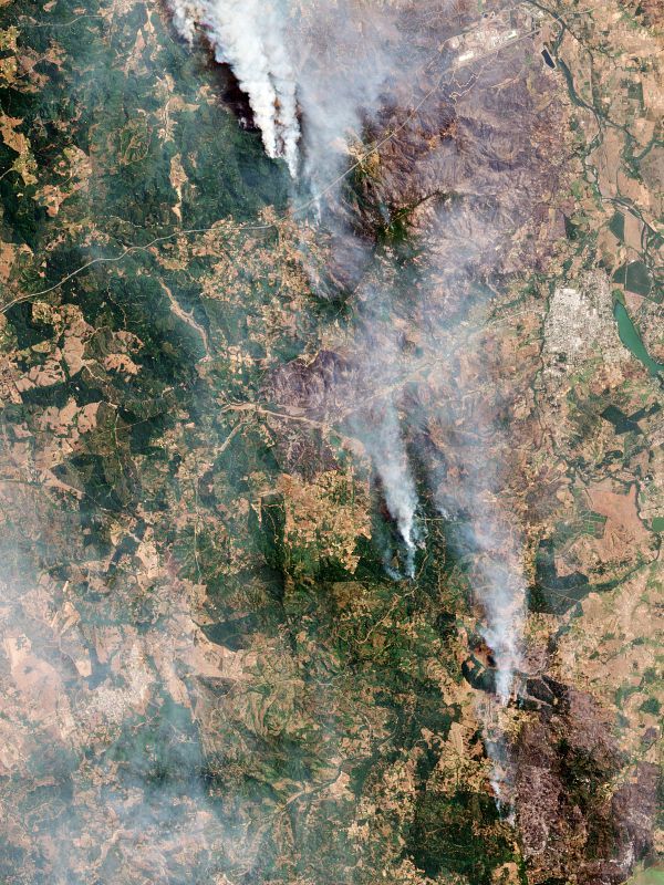
Deforestation and wildfiredetection
Forestry entities and private companies are seeking efficient ways to detect illegal deforestation and achieve early identification of forest fires in the country.