Search

Supporting Indonesia Initiatives
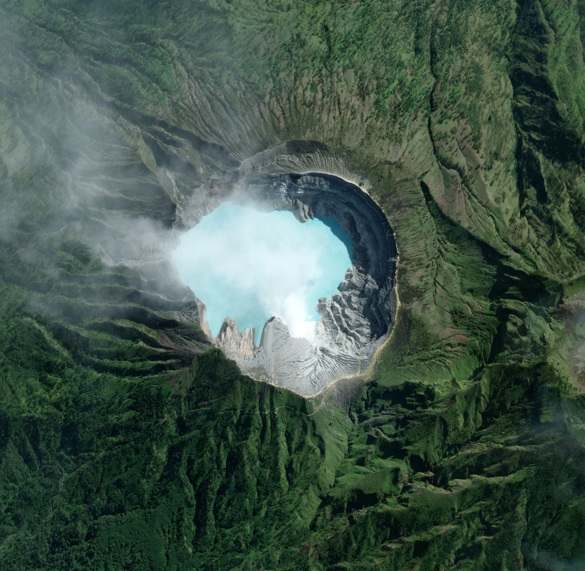
SkySatIjen Geopark, IndonesiaMay 26, 2023
About Planet Labs PBC
Planet is the leading provider of global, near-daily satellite imagery data and insights. Planet is driven by a mission to image all of Earth’s landmass every day, and make global change visible, accessible, and actionable. Founded in 2010 by three NASA scientists, Planet designs, builds, and operates the largest Earth observation fleet of satellites, providing State and Local governments insights to make the right decision at the right time. To learn more visit www.planet.com and follow us on X (formerly Twitter) at @planet
Planet Can Help Address
- Natural Disaster Response and Recovery
- Supply Chain Monitoring
- Vegetation Mapping and Forecasting
- Forest Carbon Diligence
- Illegal Deforestation
- Timber Harvesting
- Infrastructure Monitoring
- Measuring Sustainable Development Goals
- Methane Detection (Future Capability)
Learn More
Get in touch with Shih Shen Wong, Public Sector Sales Lead, APJ at shihshen@planet.com
Fueling Indonesia’s Exponential Transformation
Indonesia's strategic location provides an edge to the changing Indo-Pacific geopolitical landscape, but with it comes the challenge of mitigating climate disasters, monitoring its abundant natural resources, and enforcing sustainable mining practices. Planet's daily global imagery and key remote sensing data can help government users proactively monitor Indonesia's land and coastal territories to enable faster, data-driven decisions across ministries and agencies.HIGH-FREQUENCY, COUNTRYWIDE DATA
Planet can provide countrywide, intradaily coverage, which can reduce the need for aircraft or individual resources.
SCALABLE
Planet’s cloud-first APIs allow you to build applications quickly that scale across Indonesia's various ministries and agencies.
EASE OF USE
View and download imagery directly in your browser, or integrate with your existing GIS tools.
SUPPORTING COUNTRYWIDE EFFORTS
Planet supports the Republic's key priorities and has strong partnerships with innovative Indonesian companies driving for stability and sustainability. Planet’s flexible delivery can provide a cadence of image delivery across ministries and agencies, helping leaders to quickly plan and respond to challenges, lowering resource management cost and improving impact to its citizens.
Food Security
Planet data helps Civil Governments monitor the health and productivity of agricultural land and identify new threats that impact food security.
Defense and Intelligence
Planet pairs persistent global satellite monitoring and low latency tasking, with machine learning-based analytics to deliver early intelligence across shifting geopolitical landscapes and maritime territories.Learn More
Get in touch with Shih Shen Wong, Public Sector Sales Lead, APJ at shihshen@planet.com
© 2025 Planet Labs PBC. All rights reserved.
| Privacy Policy | California Privacy Notice |California Do Not Sell
Your Privacy Choices | Cookie Notice | Terms of Use | Sitemap
