Search
Augment Your Maritime Domain Awareness with Satellite Imagery from Planet
Journalists, analysts, companies, and governments have used Planet’s very-high resolution imagery and medium resolution imagery to give themselves the full picture of what is happening at sea and at ports worldwide. Planet’s Vessel Detection algorithm is the way of the future.

A SkySat image captured smoke showing from a building on September 22, 2023, near the port of Sevastopol in occupied Crimea, Ukraine.
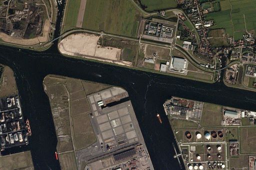
Planet’s high temporal resolution imagery collection over strategically important ports and waterways has enabled novel approaches to Maritime Domain Awareness (MDA), which historically have been restrained by limited coverage, inefficient manual processes, and complexity fusing data.
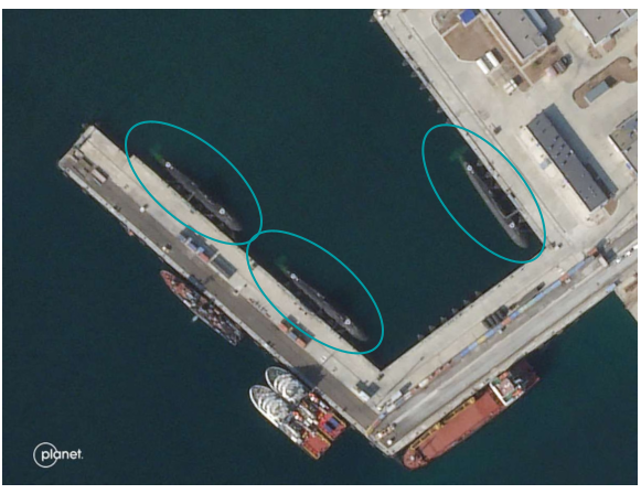
A SkySat image captured on October 1, 2023, and published by ABC News in the U.S., showing three submarines in the port of Novorossiysk, Russia. Ukrainian naval offensives had recently forced the Russian navy to move their vessels previously located in the port of Sevastopol in occupied Crimea back to Russian territory.
Journalists have taken advantage of Planet’s maritime domain imagery in fascinating ways. Getting access to denied areas can be especially hard for western journalists, so access to commercial satellite imagery has enabled them to report on topics that, without satellite imagery, they would not be able to cover. Using high spatial resolution imagery from Planet’s SkySat constellation, ABC News in the U.S. published an article describing how Ukraine’s navy was successfully able to force Russian naval vessels out of the port in occupied Sevastopol, Crimea, to a port in Russia. The ABC journalists also spoke to an analyst who is an expert in tracking oil tankers in the Black Sea who said that Russian-affiliated oil tankers had also been taking measures to avoid “the looming security threat imposed by Ukraine.” Understanding strategic moves by all parties to a conflict is enabled by Planet imagery, which has proven indispensable in other ways, too.
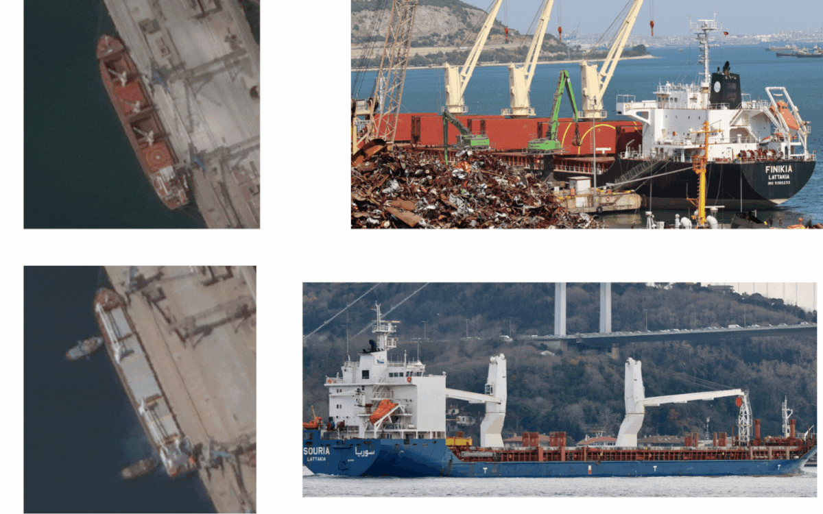
For example, The New York Times fused Planet imagery with other data sources, including maritime data from Planet partner SynMax, to create a database of oil tankers that were found to be evading sanctions on Iranian oil. The Times journalists found that the tankers had transferred at least $2.8 billion in crude oil, evading U.S. sanctions and highlighting a gap in U.S. government oversight, the Times journalists wrote. They also explained how insurance companies often leverage satellite imagery to help them investigate alleged fraud and abuse, such as a deception tactic known as AIS spoofing.
(Click here to watch a webinar entitled “Using Electro-Optical Imagery and AI Analytics in the Maritime Domain” with Planet partner SynMax.)
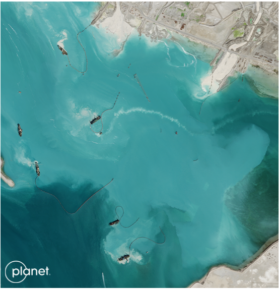
A SkySat image captured on February 13, 2023, near Hudayriyat Island, Abu Dhabi, United Arab Emirates
Stories informed by Planet's Maritime Domain Awareness Imagery


Many other news organizations have relied on Planet data for their maritime investigations and reporting; these include: The Washington Post, Newsweek, Associated Press, CNN, Financial Times, The Guardian, The Hill, and others. Outside of traditional newsrooms, other organizations have also leveraged Planet data for their investigative analyses; these include: Bellingcat, The Center for Strategic and International Studies, 38 North, AllSource Analysis, C4ADS, RUSI, Windward, Royce Geo, and others.
There are many other MDA use cases for operationalizing Planet imagery that we haven’t highlighted in this post. These include: machine learning-powered vessel detection, Order of Battle reconnaissance, ports of interest monitoring, disaster detection (e.g., unreported oil spills), humanitarian response planning and monitoring, IUU (Illegal, Unreported and Unregulated) fishing detection, border and port security, and others.
Want to learn more about using Planet data for Maritime Domain Awareness?
Fill out the form below to get access to our “Combating Illicit Activity in the Maritime Domain with Planet Data” eBook.
© 2025 Planet Labs PBC. All rights reserved.
| Privacy Policy | California Privacy Notice |California Do Not Sell
Your Privacy Choices | Cookie Notice | Terms of Use | Sitemap
