High-frequency monitoring of
mines, harvest sites and industrial
facilities for compliance and
enforcement
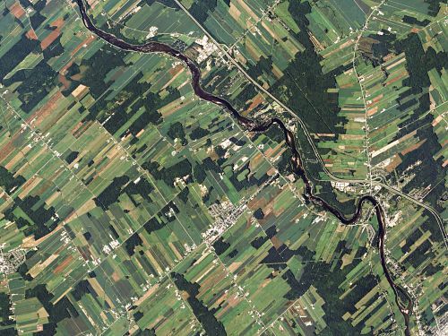
Flood monitoring and mapping
Plant and ice phenology
Ice charts, warnings,
and monitoring
GHG emissions inventory
(future capability)
About Planet Labs,Geomatics
Planet is a leading provider of satellite imagery and geospatial solutions headquartered in San Francisco, California. Founded in 2010 by three NASA scientists, Planet operates the largest Earth observation satellite constellation, which serves the medium- and high-resolution imagery needs of over 750 customers in 65 countries, from governments, commercial businesses, scientists, developers, journalists, to analysts. With over 180 satellites in orbit, Planet is capable of providing global daily data to more than 35,000 users. Our ability to rapidly design, build, launch, and adapt a large, resilient satellite network provides greater understanding of our ever-changing planet.
HIGH-FREQUENCY
Planet can provide countrywide, intradaily coverage, which can reduce the need for aircraft or individual resources.
SCALABLE
Planet’s cloud-first APIs allow you to build applications quickly that scale across Colombia's various departments.
EASE OF USE
View and download imagery directly in your browser, or integrate with your existing GIS tools.
Provincial and Federal Governments are Turning to PlanetData
Planet currently works with multiple Federal and Provincial governments to support a wide variety of conservation, climate change resilience, disaster lifecycle management, and intelligence gathering initiatives. Planet’s flexible data delivery methods and governmental contracting vehicles can deliver imagery efficiently across ministries and departments, lower operational costs and enable local leaders to make more informed decisions.
FOREIGN MILITARY INTELLIGENCE
Planet’s daily 3.7m monitoring, high-frequency 50cm tasked imagery, and machine-learning analytics help develop a fuller understanding of foreign military capabilities, actions, and intent. Military and civilian leaders can generate an accurate Order of Battle (OOB), identify and monitor critical military installations, and track movement of sensitive equipment across regions.
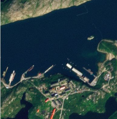
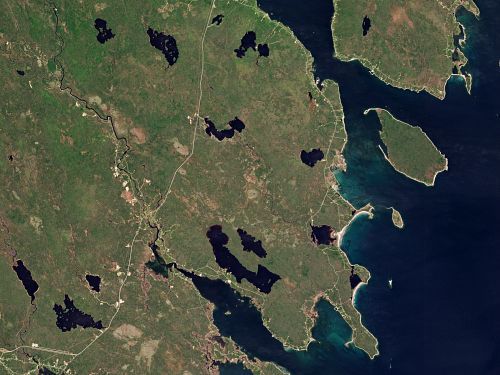
PROTECTING BOREAL FORESTS
The boreal zone holds huge amount of carbon stocks and methane, but environmental changes have re- released this stocks with significant impact on the global climate. Planet imagery can empower research, diplomacy, and protection efforts to quantify, protect, and restore natural Arctic environments.
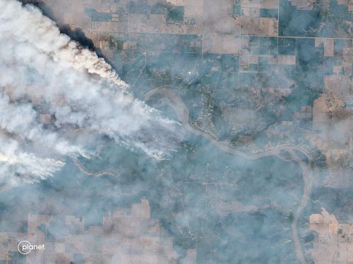
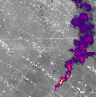
ACTIVE WILDFIRE MONITORING
Planet has aided provincial governments during the unprecedented 2023 wildfire season. Planet imagery has been used to map out forest structure and available fuels for pre-fire mitigation, active wildfire monitoring during the events, and post wildfire assessments to better understand the areas most impacted.
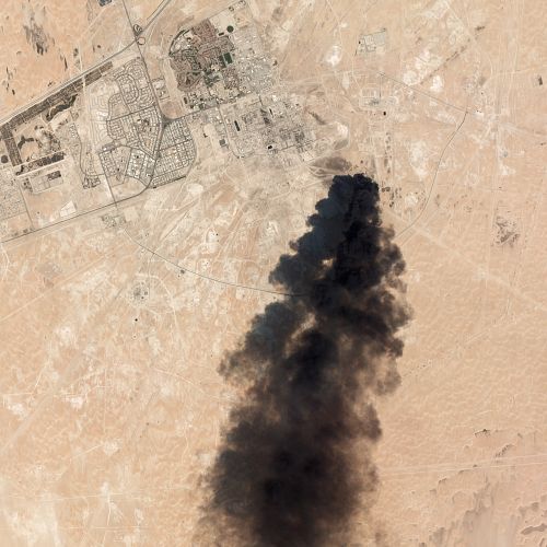
CATCHING UNEXPECTED WORLDEVENTS
Planet’s always-on monitoring mission provides greater situational awareness, allowing analysts to gain deeper insight into global events at the speed in which they unfold.
DRIVING AGRICULTURAL EFFICIENCY
The stream of daily Planet imagery enables precision crop management and crop insurance at scale by providing continuous coverage. These insights promote more efficient, equitable, profitable, and sustainable farming and crop insurance practices globally.
METHANE DETECTION (FUTURECAPABILITY)
The upcoming Planet Tanager constellation will help pinpoint, quantify and track methane and CO2emitters, enabling mitigation action and GHG reduction.
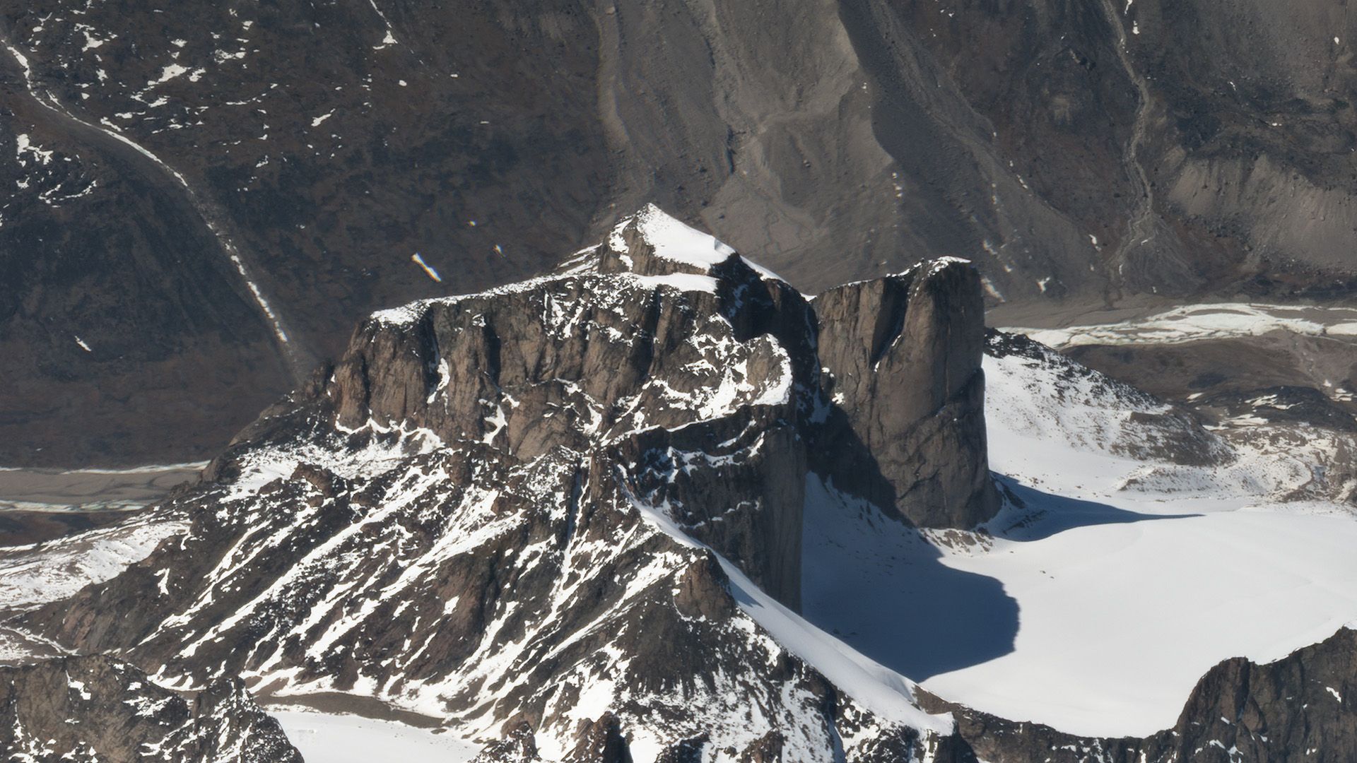
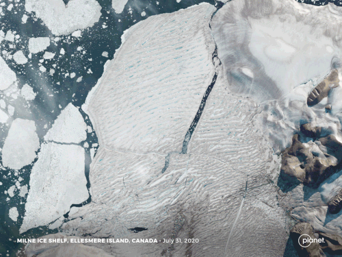
GLACIER MONITORING
Planet worked with ECCC to understand glacier pooling. Planet frequent, high-resolution data is available to scientific researchers around the world and helps address problems from global warming to urban growth.