Search

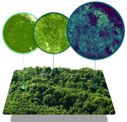
TRACKING FORESTS GLOBALLY
High-Quality, Accessible, and Consistent Data on Global Forest Change
Forests play a critical role in absorbing vast quantities of carbon dioxide, but high-fidelity estimates of the carbon they store are costly and impractical at scale. Our Forest Carbon data is designed to solve these challenges.
Forest Carbon is a global dataset of aboveground forest carbon, tree height, and canopy cover estimates to easily analyze every hectare of forest and woodland, anywhere on Earth. Cutting-edge machine learning models fuse a rich archive of historical satellite observations with high-quality, laser-derived reference data to enable carbon project accounting, digital MRV, reforestation, and deforestation monitoring. Monitor the complete spectrum of forest change, from million-acre wildfires to small agricultural clearcuts to single large tree selective harvests.
Frequent
Updated quarterly with an archive back to 2021.
Highly Accurate
Developed with cutting-edge deep learning models and validated with high-quality air- and spaceborne laser reference data.
Granular
Analyze patterns of forest change using 3 m and 30m datasets.
Scalable
A globally complete dataset and transparent pricing that supports analysis at all scales and reduces the need for field measurements or airborne surveys.
SCALE AND GRANULARITY
Monitor Global Portfolios with Unprecedented Detail
Forest Carbon is a global solution. You can understand changes to the forests and woodlands you care about, no matter where they are. Track forests and forest carbon stocks across entire regions and within specific localities, all the way down to discrete parcels of land and even individual trees. Global coverage and tree-scale data removes the burden of needing to travel to remote locations and conduct field measurements or airborne surveys.
Global
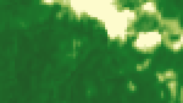
Trees absorb carbon dioxide and store it as carbon in their biomass. Our dataset quantifies Forest Carbon, Canopy Height, and Canopy Cover anywhere trees grow on Earth.
Regional
Comparing discrete parcels of land to regional baselines can help carbon project offset developers maximize their impact by understanding carbon dynamics without the need for expensive airborne or field measurement campaigns.
Local
Comparing discrete parcels of land to regional baselines can help carbon project offset developers maximize their impact by understanding carbon dynamics without the need for expensive airborne or field measurement campaigns.
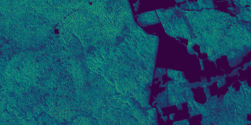
Tree
Quantify forest degradation from selective logging of high-value trees by tracing Individual tree-level disturbances using the 3 m Monitoring dataset.


Global
Trees absorb carbon dioxide and store it as carbon in their biomass. Our dataset quantifies Forest Carbon, Canopy Height, and Canopy Cover anywhere trees grow on Earth.
HOW IT WORKS
Calibrated and Evaluated With High-Quality Airborne and Spaceborne Laser Measurements
Drawing on cutting-edge scientific methods, we utilize deep learning models trained and validated on a massive global library of airborne LiDAR totalling more than 14 million square kilometers to produce estimates of forest height and cover. We leverage NASA's Global Ecosystem Dynamics Investigation (GEDI) spaceborne LiDAR to convert these estimates into wall-to-wall, GEDI-like, forest carbon data. Each metric relies on novel cloud masking, pixel selection, multi-sensor fusion (including Planetscope, Sentinel-2, Landsat, and ALOS-PALSAR-2), and temporal harmonization techniques developed to minimize year-over-year measurement variability. The result is a unique, high-quality data feed which can capture nearly tree-scale forest change globally and provide actionable monitoring of carbon stocks.


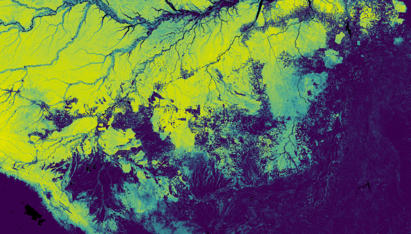
Planet's Forest Carbon Diligence estimated aboveground live carbon (left) over a region in the Congo Basin of Central Africa. Spaceborne LiDAR measurements from the GEDI mission (center) shown as a series of sparse points across the landscape. Scatterplot with associated validation metrics comparing the observed GEDI measured carbon to Planet's predicted carbon estimates at 1 sq km resolution (right).
Planet's Forest Carbon Diligence estimated aboveground live carbon (Top left) over a region in the Congo Basin of Central Africa. Spaceborne LiDAR measurements from the GEDI mission (Top Right) shown as a series of sparse points across the landscape. Scatterplot with associated validation metrics comparing the observed GEDI measured carbon to Planet's predicted carbon estimates at 1 sq km resolution (Bottom).
How It Can Help
Voluntary Carbon Markets and Jurisdictional Programs Alike Require High-Quality, Transparent Data to Assess Historical and Contemporary Forest Change
DIFFERENCE IN TOTAL ABOVEGROUND LIVE CARBON COMPARED TO 2013
(in thousand megagrams of carbon)
Aboveground Carbon Stocks Comparison:
2013 | 1,624,338 MgC vs 2023 | 1,363,801 MgC | Change: -260,537 MgC
Forest Carbon Accounting
With Forest Carbon, we empower organizations to take immediate, data-driven climate action. Forest Carbon enables the quantification of carbon stocks and forest area over time to accurately quantify losses and gains. The high precision, accuracy, and granularity provides an objective foundation for identifying and implementing improvements in carbon initiatives.
- Monitor every hectare of global portfolios
- Gather more accurate benchmarks and impacts from carbon projects
- Reduce the reliance on costly, time-consuming field and aerial surveys
Deforestation Monitoring
Forest Carbon data provides comprehensive monitoring by allowing you to detect and quantify deforestation and degradation. Stakeholders can report on their supply chains to forests globally with unprecedented granularity and confidence. In the context of the EU Deforestation Regulation (EUDR), the Forest Carbon dataset offers more precise data, helping define deforestation boundaries and providing crucial context regarding forest degradation and its precursors.
- Quantify the impact of deforestation with accurate, granular datasets, including Canopy Height and Canopy Cover
- Draw on accurate data for even remote areas with global coverage
- Gain historical context with a rich, consistent archive
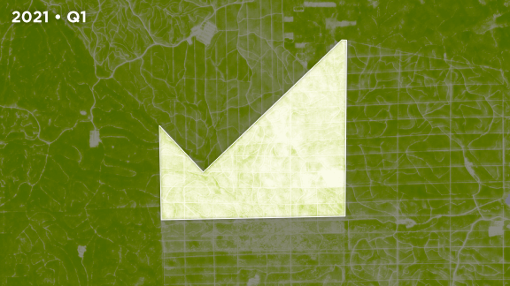
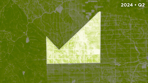
CUMULATIVE FOREST LOSS*
(in km2)
* Forest calculations based on >5 m Canopy Height and >10% Canopy Cover
AVERAGE CANOPY HEIGHT BY QUARTER
(in meters)
Reforestation Monitoring
Forest Carbon provides comprehensive data to identify and analyze reforestation and restoration projects. These efforts help trap carbon, support sustainable harvesting efforts, and may provide local economic benefits through tourism, public funding, or renewable resources. Stakeholders can use Forest Carbon to identify potential reforestation sites and monitor, analyze, and report on ongoing projects.
- Analyze carbon storage of new growth forests and old growth forests.
- Verify and quantify carbon assessments of reforestation projects to determine carbon credits.
- Manage governance and ensure compliance with publicly funded reforestation efforts.
PRODUCT COMPARISON AND PRICING
Find the Option That Fits Your Needs.
Forest Carbon
Diligence
Product
Archive access from 2013 at 30m resolution.
Datasets Included
- Canopy Cover
- Canopy Height
- Aboveground Live Carbon
Price per Hectare
$0.10

Forest Carbon
Monitoring
Product
Quarterly updates at 3m resolution.
Datasets Included
- Canopy Cover
- Canopy Height
- Aboveground Live Carbon
- Streaming Visual Basemaps
Price Per Hectare
$0.25

All-Access
Includes Diligence and Monitoring
Products
Archive 30m data and quarterly updates of 3m data
Datasets Included
- Canopy Cover
- Canopy Height
- Aboveground Live Carbon
- Streaming Visual Basemaps
Price per Hectare
Contact us for pricing


Ready to Start?
Connect with our team to see how Forest Carbon can enhance your aboveground carbon estimates.
Get StartedGET STARTED WITH OUR CARBON PARTNERS
Planet's trusted partners have built solutions leveraging Planet Forest Carbon data that can help you get started right away.

Lens by Upstream Tech is a trusted Monitoring, Reporting, and Verification (MRV) platform that enables easy and efficient project diligence, reversal monitoring, and landscape change detection.
Get Started with Lens
Cecil makes nature datasets consistent, joinable, and ready for analysis. This includes the entire process of data acquisition from curated providers, data preparation using your preferred CRS and spatial resolution, and secure data access for analysis at scale.
Get Started with CecilRead More
Learn About Forest Carbon, How We Build This Dataset, and How Our Partners Leverage This Dataset
BLOG ARTICLE
Learn about Planet's acquisition of Salo Sciences, which drove the development of our Forest Carbon data.

BLOG ARTICLE
How Upstream Tech's Lens Platform And Planet Imagery Help One Tree Planted Visualize The Future Of Global Reforestation
FAQ
Learn How to Track Forest Change Anywhere
Get more details about Forest Carbon Diligence as part of our Agile EO webinar series. For small portfolios that need an MRV solution, head to Lens from our partner Upstream Tech to analyze trends and create polished reports. Need a high-volume data feed? Reach out and start a conversation.
© 2025 Planet Labs PBC. All rights reserved.
| Privacy Policy | California Privacy Notice |California Do Not Sell
Your Privacy Choices | Cookie Notice | Terms of Use | Sitemap
